IMAGES TAKEN NEAR TO
Bakehouse Lane, NORTHAMPTON, NN6 0ED
Introduction
This page details the photographs taken nearby to Bakehouse Lane, NN6 0ED by members of the Geograph project.
The Geograph project started in 2005 with the aim of publishing, organising and preserving representative images for every square kilometre of Great Britain, Ireland and the Isle of Man.

There are currently over 7.5m images from over14,400 individuals and you can help contribute to the project by visiting https://www.geograph.org.uk
Image Map
Images are licensed for reuse under creativecommons.org/licenses/by-sa/2.0
Notes
- Clicking on the map will re-center to the selected point.
- The higher the marker number, the further away the image location is from the centre of the postcode.
Image Listing (19 Images Found)
Images are licensed for reuse under creativecommons.org/licenses/by-sa/2.0
Image
Details
Distance
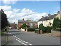
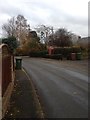
1
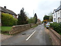
Bakehouse Lane
Houses in Mears Ashby.
Image: © Burgess Von Thunen
Taken: 7 Apr 2014
0.00 miles
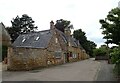
2
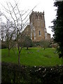
All Saints Church
In the village of Mears Ashby
Image: © Kokai
Taken: 23 Jan 2006
0.05 miles
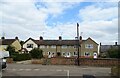
3
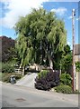
Suburban willow, Wellingborough Road, Mears Ashby
Image: © Humphrey Bolton
Taken: 25 Aug 2011
0.05 miles
4
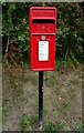
Elizabeth II postbox on Wellingborough Road
Postbox No. NN6 133.
Image: © JThomas
Taken: 21 Sep 2022
0.05 miles
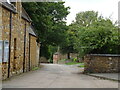
10
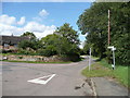
Highfield Road, Mears Ashby
Taken from its junction with North Street and Wellingborough Road.
Image: © Humphrey Bolton
Taken: 25 Aug 2011
0.09 miles