IMAGES TAKEN NEAR TO
Countess Road, NN5 7FB
Introduction
This page details the photographs taken nearby to Countess Road, NN5 7FB by members of the Geograph project.
The Geograph project started in 2005 with the aim of publishing, organising and preserving representative images for every square kilometre of Great Britain, Ireland and the Isle of Man.

There are currently over 7.5m images from over14,400 individuals and you can help contribute to the project by visiting https://www.geograph.org.uk
Image Map (Loading...)


Getting Data...Please wait
Leaflet Map data © OpenStreetMap
Images are licensed for reuse under creativecommons.org/licenses/by-sa/2.0
Notes
- Clicking on the map will re-center to the selected point.
- The higher the marker number, the further away the image location is from the centre of the postcode.
Image Listing (16 Images Found)
Images are licensed for reuse under creativecommons.org/licenses/by-sa/2.0
Image
Details
Distance
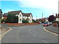
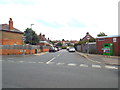
1
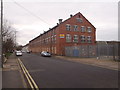
Countess Road
Industrial units in Spencer.
Image: © Burgess Von Thunen
Taken: 5 Feb 2016
0.03 miles
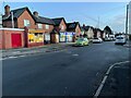
2
Countess Road
1930s council houses in Spencer.
Image: © Burgess Von Thunen
Taken: 5 Feb 2016
0.07 miles
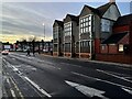
3
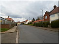
Countess Road
1930s council houses in St James.
Image: © Burgess Von Thunen
Taken: 26 Mar 2014
0.08 miles
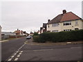
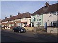
4
Baring Road, Northampton
Baring Road is a residential road in the suburbs of Northampton.
National Cycle Network route 6 follows this road as it passes through Northampton using quiet streets.
Image: © Malc McDonald
Taken: 28 Jul 2018
0.13 miles
7
Tintern Avenue
1950s council houses in Spencer.
Image: © Burgess Von Thunen
Taken: 29 Sep 2015
0.17 miles
8
Tintern Avenue, Northampton
Tintern Avenue is a residential road in Northampton's suburbs.
Image: © Malc McDonald
Taken: 28 Jul 2018
0.17 miles
9
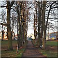
Victoria Park, St James' End, Northampton
Victoria Park is situated within a mile of the town centre in the St James district of Northampton and provides a quiet retreat from the busy roads around it. Half of the park was gifted to the town by the Earl Spencer in 1898, making it the second oldest designated park in Northampton and later another 8 acres were purchased from the Earl in 1910/11, making a green space of 16 acres. Ahead are houses lining Spencer Bridge Road (part of the A428) The St James’ area, or more formally: St James' End (but known locally as Jimmy’s End) has been administered as part of the city since 1900. St James' End is now in the Borough Council’s St James Ward.
Image: © David Hallam-Jones
Taken: 27 Dec 2016
0.20 miles