IMAGES TAKEN NEAR TO
Vincent Close, NORTHAMPTON, NN5 6YA
Introduction
This page details the photographs taken nearby to Vincent Close, NN5 6YA by members of the Geograph project.
The Geograph project started in 2005 with the aim of publishing, organising and preserving representative images for every square kilometre of Great Britain, Ireland and the Isle of Man.

There are currently over 7.5m images from over14,400 individuals and you can help contribute to the project by visiting https://www.geograph.org.uk
Image Map (Loading...)


Getting Data...Please wait
Leaflet Map data © OpenStreetMap
Images are licensed for reuse under creativecommons.org/licenses/by-sa/2.0
Notes
- Clicking on the map will re-center to the selected point.
- The higher the marker number, the further away the image location is from the centre of the postcode.
Image Listing (12 Images Found)
Images are licensed for reuse under creativecommons.org/licenses/by-sa/2.0
Image
Details
Distance
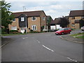
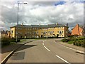
1
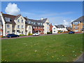
Berrywod Drive
2000s houses in Duston.
Image: © Burgess Von Thunen
Taken: 10 Apr 2014
0.08 miles
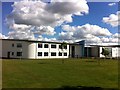
2
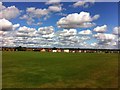
The Duston School
Playing fields.
Image: © Burgess Von Thunen
Taken: 7 Sep 2013
0.12 miles
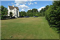
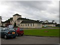
3
Berrywood Hospital
A new purpose-built facility replacing the Pendered Centre, providing facilities for inpatient mental health services for adults and older people, an assessment and treatment unit for people with learning disabilities and a low secure unit.
Image: © Burgess Von Thunen
Taken: 7 Sep 2013
0.12 miles
4
Weggs Farm Road
Looking from Malpas Road junction.
Image: © Oast House Archive
Taken: 1 Jul 2011
0.14 miles
5
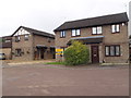
Aquitane Close
1980s houses in St Giles Park.
Image: © Burgess Von Thunen
Taken: 15 Sep 2015
0.17 miles
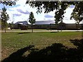
6
The Duston School
A foundation trust secondary school specializing in business, enterprise and science.
Image: © Burgess Von Thunen
Taken: 7 Sep 2013
0.20 miles
7
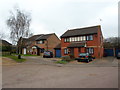
Bollinger Close
1980s houses in New Duston.
Image: © Burgess Von Thunen
Taken: 10 Mar 2014
0.21 miles
8
Duston
The Pendered Centre. Part of the Hospital Complex.
Image: © Ian Rob
Taken: 31 Oct 2006
0.21 miles
9
Berrywood Drive
A crescent of three-storey houses in Duston.
Image: © Burgess Von Thunen
Taken: 29 Apr 2013
0.21 miles