IMAGES TAKEN NEAR TO
Dane Ridge, NORTHAMPTON, NN5 6HQ
Introduction
This page details the photographs taken nearby to Dane Ridge, NN5 6HQ by members of the Geograph project.
The Geograph project started in 2005 with the aim of publishing, organising and preserving representative images for every square kilometre of Great Britain, Ireland and the Isle of Man.

There are currently over 7.5m images from over14,400 individuals and you can help contribute to the project by visiting https://www.geograph.org.uk
Image Map (Loading...)


Getting Data...Please wait
Leaflet Map data © OpenStreetMap
Images are licensed for reuse under creativecommons.org/licenses/by-sa/2.0
Notes
- Clicking on the map will re-center to the selected point.
- The higher the marker number, the further away the image location is from the centre of the postcode.
Image Listing (19 Images Found)
Images are licensed for reuse under creativecommons.org/licenses/by-sa/2.0
Image
Details
Distance
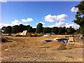
1
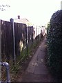
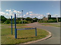
Public Footpath to Southfield Road
From the site of the former Princess Marina Hospital.
Image: © Burgess Von Thunen
Taken: 7 Sep 2013
0.08 miles
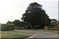
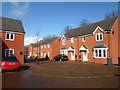
3
Marina Park
Residential development on the site of the former Princess Marina hospital.
Image: © Burgess Von Thunen
Taken: 7 Sep 2013
0.13 miles
5
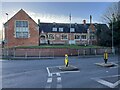
Duston Kindergarten in the old school building
Image: © Philip Jeffrey
Taken: 9 Jan 2022
0.16 miles
6
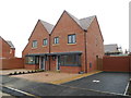
Marina Gardens
2010s houses in Duston.
Image: © Burgess Von Thunen
Taken: 17 Feb 2014
0.16 miles
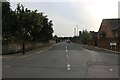
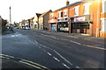
7
Sandringham Close, Duston, Northampton
Image: © Alex McGregor
Taken: 20 Jun 2011
0.17 miles
8
Dave Bowen Close
2010s houses in Duston.
Image: © Burgess Von Thunen
Taken: 27 Feb 2014
0.17 miles