IMAGES TAKEN NEAR TO
Ambush Street, NORTHAMPTON, NN5 5DX
Introduction
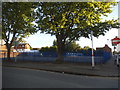
This page details the photographs taken nearby to Ambush Street, NN5 5DX by members of the Geograph project.
The Geograph project started in 2005 with the aim of publishing, organising and preserving representative images for every square kilometre of Great Britain, Ireland and the Isle of Man.

There are currently over 7.5m images from over14,400 individuals and you can help contribute to the project by visiting https://www.geograph.org.uk
Image Map
Images are licensed for reuse under creativecommons.org/licenses/by-sa/2.0
Notes
- Clicking on the map will re-center to the selected point.
- The higher the marker number, the further away the image location is from the centre of the postcode.
Image Listing (82 Images Found)
Images are licensed for reuse under creativecommons.org/licenses/by-sa/2.0
Image
Details
Distance
1
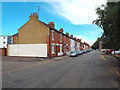
St. James' Park Road, Northampton
Terraced housing on St. James' Park Road in Northampton.
St. James' Park Road is on the route of National Cycle Network route 6, as it passes through Northampton using quiet streets.
Image: © Malc McDonald
Taken: 28 Jul 2018
0.06 miles
2
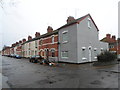
St James Park Road
A former butcher's shop on the corner of Marlborough Road.
Image: © Burgess Von Thunen
Taken: 8 Jan 2015
0.07 miles
3
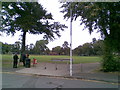
Victoria Park
The entrance to the park from Marlborough Road.
Image: © Burgess Von Thunen
Taken: 23 Aug 2011
0.09 miles
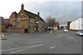
4
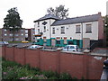
Castle Inn
Closed pub at the end of St James Park Road.
Image: © Oast House Archive
Taken: 1 Jul 2011
0.09 miles
5
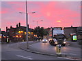
St James Road
Sunset over the A428.
Image: © Oast House Archive
Taken: 1 Jul 2011
0.10 miles
7
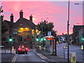
St James Road
Sunset over the A428.
Image: © Oast House Archive
Taken: 1 Jul 2011
0.10 miles
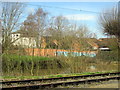
9
Car park on St James Road, Northampton
Image: © David Howard
Taken: 21 May 2017
0.11 miles
10
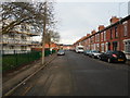
Stanley Road
Victorian terraces and 1950s council flats.
Image: © Burgess Von Thunen
Taken: 7 Jan 2015
0.11 miles