IMAGES TAKEN NEAR TO
Dayrell Road, NORTHAMPTON, NN4 9RR
Introduction
This page details the photographs taken nearby to Dayrell Road, NN4 9RR by members of the Geograph project.
The Geograph project started in 2005 with the aim of publishing, organising and preserving representative images for every square kilometre of Great Britain, Ireland and the Isle of Man.

There are currently over 7.5m images from over14,400 individuals and you can help contribute to the project by visiting https://www.geograph.org.uk
Image Map
Images are licensed for reuse under creativecommons.org/licenses/by-sa/2.0
Notes
- Clicking on the map will re-center to the selected point.
- The higher the marker number, the further away the image location is from the centre of the postcode.
Image Listing (34 Images Found)
Images are licensed for reuse under creativecommons.org/licenses/by-sa/2.0
Image
Details
Distance
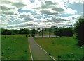
2
Hunsbury Park Primary School
In Danes Camp.
Image: © Burgess Von Thunen
Taken: 4 Jun 2012
0.04 miles
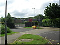
3
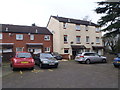
Dimock Square
1970s council houses and a playground.
Image: © Burgess Von Thunen
Taken: 3 Jun 2010
0.12 miles
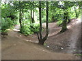
4
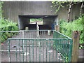
Danes Camp
Danes Camp Way underpass.
Image: © Burgess Von Thunen
Taken: 4 Jun 2012
0.13 miles
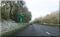
7
Bank or quarry side, Hunsbury Hill Country Park
The Hunsbury Hill Country Park is the site of a former quarry, and I am not sure if this was part of its workings, or part of the rampart surrounding the eponymous Iron Age Hillfort, about which see:
https://northants-archaeology.org.uk/Hunsbury_Hillfort.asp
Image: © Chris
Taken: 21 Apr 2024
0.19 miles
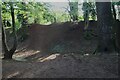
8
Hunsbury Hill Country Park
Jump site on the ramparts of an iron age hill fort.
Image: © Burgess Von Thunen
Taken: 4 Jun 2012
0.19 miles
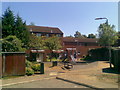
9
Marnock Square
1980s council houses in Camp Hill.
Image: © Burgess Von Thunen
Taken: 3 Feb 2016
0.19 miles
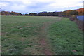
10
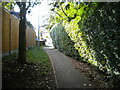
Footpath to Piccadilly Close, Briar Hill
From Southwood Hill.
Image: © Richard Vince
Taken: 9 Oct 2021
0.19 miles