
IMAGES TAKEN NEAR TO
Buchanan Close, NORTHAMPTON, NN4 8RA
Introduction
This page details the photographs taken nearby to Buchanan Close, NN4 8RA by members of the Geograph project.
The Geograph project started in 2005 with the aim of publishing, organising and preserving representative images for every square kilometre of Great Britain, Ireland and the Isle of Man.

There are currently over 7.5m images from over14,400 individuals and you can help contribute to the project by visiting https://www.geograph.org.uk
Image Map
Images are licensed for reuse under creativecommons.org/licenses/by-sa/2.0
Notes
- Clicking on the map will re-center to the selected point.
- The higher the marker number, the further away the image location is from the centre of the postcode.
Image Listing (14 Images Found)
Images are licensed for reuse under creativecommons.org/licenses/by-sa/2.0
Image
Details
Distance
1
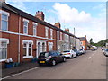
Thirlestaine Road
Victorian terraces in Far Cotton.
Image: © Burgess Von Thunen
Taken: 4 Sep 2015
0.13 miles

3
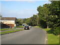
Descending Ring Way, Briar Hill
For some reason, the pavement on the right hand side (on which the photographer is standing) disappears north of this point.
Image: © Richard Vince
Taken: 9 Oct 2021
0.18 miles
4
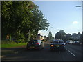
Towcester Road, Far Cotton
At the lights for Queen Eleanor Road
Image: © David Howard
Taken: 8 Aug 2012
0.18 miles
5
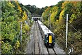
Train leaving Hunsbury Hill Tunnel
A train from London Euston to Northampton leaving the north portal of Hunsbury Hill Tunnel heading for Northampton Station. The train is formed of two 4-car Class 350 electric units, with No. 350368 leading.
Image: © Bob Walters
Taken: 24 Oct 2022
0.18 miles
8
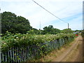
Far Cotton
A bridleway near the entrance to Hunsbury Hill railway tunnel, just the other side of the brambles.
Image: © Burgess Von Thunen
Taken: 26 Jun 2014
0.19 miles
9
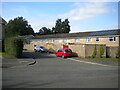
Cul de sac off Ring Way, Briar Hill
Apparently leading to the backs of houses.
Image: © Richard Vince
Taken: 9 Oct 2021
0.19 miles
10
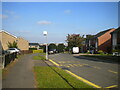
South end of Ring Way, Briar Hill
With Northampton town centre just visible on the horizon.
Image: © Richard Vince
Taken: 9 Oct 2021
0.20 miles