IMAGES TAKEN NEAR TO
Braunston Close, NORTHAMPTON, NN4 8QZ
Introduction
This page details the photographs taken nearby to Braunston Close, NN4 8QZ by members of the Geograph project.
The Geograph project started in 2005 with the aim of publishing, organising and preserving representative images for every square kilometre of Great Britain, Ireland and the Isle of Man.

There are currently over 7.5m images from over14,400 individuals and you can help contribute to the project by visiting https://www.geograph.org.uk
Image Map
Images are licensed for reuse under creativecommons.org/licenses/by-sa/2.0
Notes
- Clicking on the map will re-center to the selected point.
- The higher the marker number, the further away the image location is from the centre of the postcode.
Image Listing (18 Images Found)
Images are licensed for reuse under creativecommons.org/licenses/by-sa/2.0
Image
Details
Distance
1
Lancaster Way
1990s houses in Far Cotton.
Image: © Burgess Von Thunen
Taken: 24 Mar 2014
0.10 miles
2
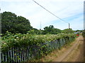
Far Cotton
A bridleway near the entrance to Hunsbury Hill railway tunnel, just the other side of the brambles.
Image: © Burgess Von Thunen
Taken: 26 Jun 2014
0.10 miles
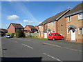
3
Kingmaker Way
2000s houses in Buckingham Fields.
Image: © Burgess Von Thunen
Taken: 7 Nov 2014
0.10 miles
4
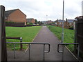
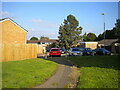
Briar Hill
Bridleway through modern housing.
Image: © Burgess Von Thunen
Taken: 4 Jun 2012
0.12 miles
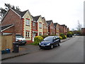
5
Lancaster Way, Far Cotton
Part of a recent housing estate.
Image: © David Howard
Taken: 8 Aug 2012
0.14 miles
6
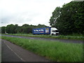
You Shop, We Drop.
Tesco lorry on Danes Camp Way.
Image: © Burgess Von Thunen
Taken: 4 Jun 2012
0.15 miles
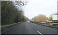
7
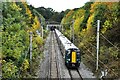
Train leaving Hunsbury Hill Tunnel
A train from London Euston to Northampton leaving the north portal of Hunsbury Hill Tunnel heading for Northampton Station. The train is formed of two 4-car Class 350 electric units, with No. 350368 leading.
Image: © Bob Walters
Taken: 24 Oct 2022
0.16 miles
8
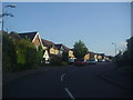
Lancaster Way, Far Cotton
Typical early 21st century anonymous new houses. The gables have been revived from the 1930s.
Image: © David Howard
Taken: 8 Aug 2012
0.16 miles
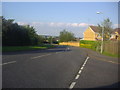
9
Southwood Hill, Briar Hill (1)
Part of a complex of roads that are all named Southwood Hill, seen from a footpath linking it with housing off other parts.
Image: © Richard Vince
Taken: 9 Oct 2021
0.19 miles