IMAGES TAKEN NEAR TO
Mortimer Close, NORTHAMPTON, NN4 8LZ
Introduction
This page details the photographs taken nearby to Mortimer Close, NN4 8LZ by members of the Geograph project.
The Geograph project started in 2005 with the aim of publishing, organising and preserving representative images for every square kilometre of Great Britain, Ireland and the Isle of Man.

There are currently over 7.5m images from over14,400 individuals and you can help contribute to the project by visiting https://www.geograph.org.uk
Image Map
Images are licensed for reuse under creativecommons.org/licenses/by-sa/2.0
Notes
- Clicking on the map will re-center to the selected point.
- The higher the marker number, the further away the image location is from the centre of the postcode.
Image Listing (14 Images Found)
Images are licensed for reuse under creativecommons.org/licenses/by-sa/2.0
Image
Details
Distance
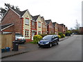
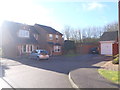
1
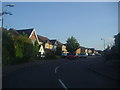
Lancaster Way, Far Cotton
Typical early 21st century anonymous new houses. The gables have been revived from the 1930s.
Image: © David Howard
Taken: 8 Aug 2012
0.03 miles
2
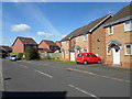
Lancaster Way
1990s houses in Far Cotton.
Image: © Burgess Von Thunen
Taken: 24 Mar 2014
0.04 miles
3
Lancaster Way, Far Cotton
Part of a recent housing estate.
Image: © David Howard
Taken: 8 Aug 2012
0.05 miles
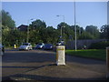
4
Towcester Road
A service road off Towcester in Delepre.
Image: © Burgess Von Thunen
Taken: 16 May 2016
0.08 miles
5
Kingmaker Way
2000s houses in Buckingham Fields.
Image: © Burgess Von Thunen
Taken: 7 Nov 2014
0.10 miles
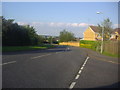
6
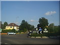
Roundabout on Towcester Road, Far Cotton
Image: © David Howard
Taken: 8 Aug 2012
0.14 miles
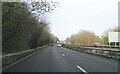
7
Roundabout on Towcester Road, Far Cotton
Image: © David Howard
Taken: 8 Aug 2012
0.14 miles
9
Tewkesbury Close
1990s houses in Far Cotton.
Image: © Burgess Von Thunen
Taken: 29 Mar 2016
0.17 miles
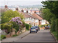
10
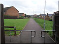
Briar Hill
Bridleway through modern housing.
Image: © Burgess Von Thunen
Taken: 4 Jun 2012
0.17 miles