
IMAGES TAKEN NEAR TO
Henry Bird Way, NORTHAMPTON, NN4 8GA
Introduction
This page details the photographs taken nearby to Henry Bird Way, NN4 8GA by members of the Geograph project.
The Geograph project started in 2005 with the aim of publishing, organising and preserving representative images for every square kilometre of Great Britain, Ireland and the Isle of Man.

There are currently over 7.5m images from over14,400 individuals and you can help contribute to the project by visiting https://www.geograph.org.uk
Image Map
Images are licensed for reuse under creativecommons.org/licenses/by-sa/2.0
Notes
- Clicking on the map will re-center to the selected point.
- The higher the marker number, the further away the image location is from the centre of the postcode.
Image Listing (106 Images Found)
Images are licensed for reuse under creativecommons.org/licenses/by-sa/2.0
Image
Details
Distance
1
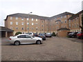
Johnson Court
2000s flats in Cotton End.
Image: © Burgess Von Thunen
Taken: 18 Sep 2015
0.08 miles
2
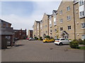
Henry Bird Way
2000s flats in Southbridge.
Image: © Burgess Von Thunen
Taken: 6 May 2016
0.08 miles
3
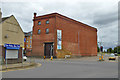
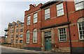
Former railway warehouse, Cotton End, Northampton
Now offices, entered from the rear, which looks slightly better than the front. The poster describes the building having 'character', estate agent's parlance for 'not pretty'. The bottom near corner is stone, presumably a shared wall with a building to the right, demolished when the road was driven through.
Image: © Robin Webster
Taken: 4 Sep 2016
0.11 miles
4
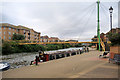
River Nene, Wathen Wigg Bridge
Footbridge opened in 2005. It is named after Rev Samuel Wathen Wigg who is credited with founding the Northampton Saints Rugby Club when, as the curate at St James Parish Church, he took the boys' improvement class and started a rugby team called Northampton St James which later became known as “the Saints”. The bridge is painted in the club colours.
Image: © David Dixon
Taken: 18 Aug 2018
0.11 miles
5
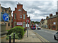
Building by former railway goods station, Northampton
Ghost writing advises 'LMS ... coal and cattle station.
Image: © Robin Webster
Taken: 4 Sep 2016
0.11 miles
7
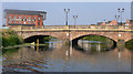
Latimer and Crick Northampton
Latimer and Crick building behind Cotton End bridge in Northampton
Image: © Mike Todd
Taken: 26 Jun 2010
0.11 miles
8

Wathen Wigg Bridge, Northampton
The bridge crosses the River Nene linking the town centre on the left side of the river to the northern edge of Far Cotton on the right bank. It is a foot and cycle bridge of cable-stay design and was opened in 2005. It is named for Rev. Wathen Wigg who founded Northampton Saints Rugby Club in 1880.
Image: © Rod Grealish
Taken: 7 Apr 2026
0.11 miles
9
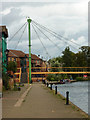
Riverside Walk
Beside the River Nene approaching Town Lock
Image: © Richard Croft
Taken: 5 Sep 2011
0.12 miles
10
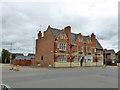
The Old White Hart, Cotton End, Northampton
Image: © Robin Webster
Taken: 4 Sep 2016
0.12 miles