IMAGES TAKEN NEAR TO
Atterbury Way, NORTHAMPTON, NN4 7AU
Introduction
This page details the photographs taken nearby to Atterbury Way, NN4 7AU by members of the Geograph project.
The Geograph project started in 2005 with the aim of publishing, organising and preserving representative images for every square kilometre of Great Britain, Ireland and the Isle of Man.

There are currently over 7.5m images from over14,400 individuals and you can help contribute to the project by visiting https://www.geograph.org.uk
Image Map
Images are licensed for reuse under creativecommons.org/licenses/by-sa/2.0
Notes
- Clicking on the map will re-center to the selected point.
- The higher the marker number, the further away the image location is from the centre of the postcode.
Image Listing (19 Images Found)
Images are licensed for reuse under creativecommons.org/licenses/by-sa/2.0
Image
Details
Distance
1
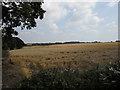
Farmland near Great Houghton
Ripe wheat.
Image: © Burgess Von Thunen
Taken: 28 Aug 2013
0.07 miles
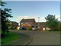
2
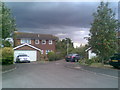
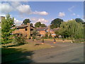
Lime Farm Way
1980s houses in Great Houghton.
Image: © Burgess Von Thunen
Taken: 4 Aug 2010
0.10 miles
3
Willow Crescent
1970s houses in Great Houghton.
Image: © Burgess Von Thunen
Taken: 28 Aug 2013
0.10 miles
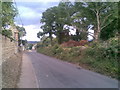
4
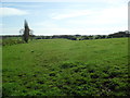
Farmland near Great Houghton
Bridleway across pasture land.
Image: © Burgess Von Thunen
Taken: 22 Apr 2012
0.14 miles
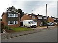
5
Wymersley Close
Mixed 1980s houses.
Image: © Burgess Von Thunen
Taken: 15 Jun 2010
0.15 miles
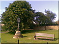
7
High Street
The land on the right looks ripe for development.
Image: © Burgess Von Thunen
Taken: 4 Aug 2010
0.16 miles
8
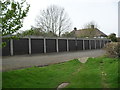
Great Houghton
Some garages on the edge of the village.
Image: © Burgess Von Thunen
Taken: 14 Apr 2012
0.16 miles
9
High Street
1970s houses in Great Houghton.
Image: © Burgess Von Thunen
Taken: 5 Aug 2010
0.19 miles
10

Paget Close
1980s houses in Great Houghton.
Image: © Burgess Von Thunen
Taken: 5 Aug 2010
0.19 miles