IMAGES TAKEN NEAR TO
Falcon Way, NORTHAMPTON, NN4 6GT
Introduction
This page details the photographs taken nearby to Falcon Way, NN4 6GT by members of the Geograph project.
The Geograph project started in 2005 with the aim of publishing, organising and preserving representative images for every square kilometre of Great Britain, Ireland and the Isle of Man.

There are currently over 7.5m images from over14,400 individuals and you can help contribute to the project by visiting https://www.geograph.org.uk
Image Map
Images are licensed for reuse under creativecommons.org/licenses/by-sa/2.0
Notes
- Clicking on the map will re-center to the selected point.
- The higher the marker number, the further away the image location is from the centre of the postcode.
Image Listing (9 Images Found)
Images are licensed for reuse under creativecommons.org/licenses/by-sa/2.0
Image
Details
Distance
2
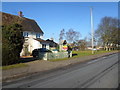
The Warren
1950s council houses in Hardingstone.
Image: © Burgess Von Thunen
Taken: 9 Feb 2015
0.19 miles
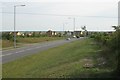
3
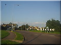
Roundabout on Newport Pagnell Road, Wootton
I had been following the balloon all the way from the town centre and lucky it crept in here.
Image: © David Howard
Taken: 8 Aug 2012
0.20 miles
4
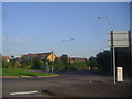
Roundabout on Newport Pagnell Road, Wootton
Image: © David Howard
Taken: 8 Aug 2012
0.21 miles
5
Power lines cross Landimore Road
Landimore Road connects residential areas with the extensive Brackmills industrial estate south of Northampton.
Image: © Robin Stott
Taken: 14 Jun 2011
0.22 miles
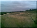
6
South end of Landimore Road
Looking south towards recent housing at Wootton and the junction with the Newport Pagnell road.
Image: © Robin Stott
Taken: 14 Jun 2011
0.22 miles
7

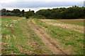
Footpath southeast from Landimore Road
The yellow and white sign from www.homesandcommunities.co.uk reads: "Private Land / Access prohibited except for the use of the public footpath / Please keep to the footpath and keep dogs on a lead." The oversprayed message in red reads: "This is a public right of way / Please keep using it". A similar sign across the road adds: "Say no to 5,000 houses". What's going on?
Image: © Robin Stott
Taken: 14 Jun 2011
0.24 miles
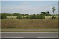
8
Disused land near Hardingstone
This land sits between Hardingstone and Brackmills industrial estate.
Image: © Burgess Von Thunen
Taken: 6 Aug 2010
0.24 miles
9
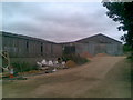
The Farm
This barn appears to be used primarily for storage. The building equipment to the left relates to Heritage Farm residential development which is adjacent.
Image: © Burgess Von Thunen
Taken: 6 Aug 2010
0.25 miles