
IMAGES TAKEN NEAR TO
Back Lane, NORTHAMPTON, NN4 6BY
Introduction
This page details the photographs taken nearby to Back Lane, NN4 6BY by members of the Geograph project.
The Geograph project started in 2005 with the aim of publishing, organising and preserving representative images for every square kilometre of Great Britain, Ireland and the Isle of Man.

There are currently over 7.5m images from over14,400 individuals and you can help contribute to the project by visiting https://www.geograph.org.uk
Image Map
Images are licensed for reuse under creativecommons.org/licenses/by-sa/2.0
Notes
- Clicking on the map will re-center to the selected point.
- The higher the marker number, the further away the image location is from the centre of the postcode.
Image Listing (20 Images Found)
Images are licensed for reuse under creativecommons.org/licenses/by-sa/2.0
Image
Details
Distance
1
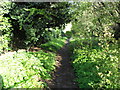
Hardingstone
Footpath from Hardingstone to Northampton.
Image: © Burgess Von Thunen
Taken: 22 Apr 2012
0.03 miles
2

High Street, Hardingstome
This is the eastern end of Hardingstone's High Street - part of a village now absorbed into Northampton's suburbs but still retaining something of a rural feel. Kuts & Kurls is, as the name suggests, a hairdressing salon.
Image: © Stephen McKay
Taken: 29 Nov 2018
0.06 miles
3

The Sun, Hardingstone
The Sun on Hardingstone High Street is well served by local buses; in fact buses on Stagecoach's route 7 to the centre of Northampton stop right outside the door.
Image: © Stephen McKay
Taken: 29 Nov 2018
0.07 miles
4
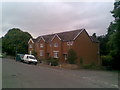
High Street
1970s terraces in Hardingstone.
Image: © Burgess Von Thunen
Taken: 6 Aug 2010
0.10 miles
5
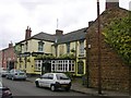
Hardingstone
The Sun Public House and Cottages.
Image: © Ian Rob
Taken: 16 May 2007
0.11 miles
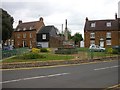
7
Bouverie Road
1950s bungalows in Hardingstone.
Image: © Burgess Von Thunen
Taken: 6 Aug 2010
0.13 miles
8
Bouverie Road
1950s bungalows in Hardingstone.
Image: © Burgess Von Thunen
Taken: 6 Aug 2010
0.14 miles
9
High Street
1930s semis in Hardingstone.
Image: © Burgess Von Thunen
Taken: 10 Apr 2015
0.14 miles
10
Bouverie Road
1950s houses in Hardingstone.
Image: © Burgess Von Thunen
Taken: 6 Aug 2010
0.17 miles