IMAGES TAKEN NEAR TO
Earlsfield Close, NORTHAMPTON, NN4 6BQ
Introduction
This page details the photographs taken nearby to Earlsfield Close, NN4 6BQ by members of the Geograph project.
The Geograph project started in 2005 with the aim of publishing, organising and preserving representative images for every square kilometre of Great Britain, Ireland and the Isle of Man.

There are currently over 7.5m images from over14,400 individuals and you can help contribute to the project by visiting https://www.geograph.org.uk
Image Map
Images are licensed for reuse under creativecommons.org/licenses/by-sa/2.0
Notes
- Clicking on the map will re-center to the selected point.
- The higher the marker number, the further away the image location is from the centre of the postcode.
Image Listing (18 Images Found)
Images are licensed for reuse under creativecommons.org/licenses/by-sa/2.0
Image
Details
Distance
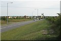
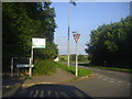
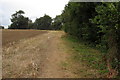
2
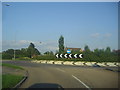
Roundabout on Newport Pagnell Road, Hardingstone
Image: © David Howard
Taken: 8 Aug 2012
0.07 miles
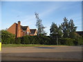
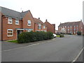
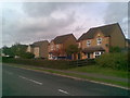
4
Copymoor Close
2000s houses in Wootton Fields.
Image: © Burgess Von Thunen
Taken: 2 Feb 2016
0.09 miles
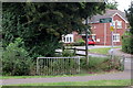
5
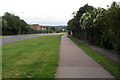
South end of Landimore Road
Looking south towards recent housing at Wootton and the junction with the Newport Pagnell road.
Image: © Robin Stott
Taken: 14 Jun 2011
0.12 miles
8
Elm Grove
2000s houses in Wootton.
Image: © Burgess Von Thunen
Taken: 2 Apr 2014
0.15 miles
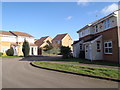
10
Wootton Hope Drive
1990s houses in Wootton Fields.
Image: © Burgess Von Thunen
Taken: 23 Sep 2010
0.17 miles