IMAGES TAKEN NEAR TO
Fosberry Close, NORTHAMPTON, NN4 6AW
Introduction
This page details the photographs taken nearby to Fosberry Close, NN4 6AW by members of the Geograph project.
The Geograph project started in 2005 with the aim of publishing, organising and preserving representative images for every square kilometre of Great Britain, Ireland and the Isle of Man.

There are currently over 7.5m images from over14,400 individuals and you can help contribute to the project by visiting https://www.geograph.org.uk
Image Map
Images are licensed for reuse under creativecommons.org/licenses/by-sa/2.0
Notes
- Clicking on the map will re-center to the selected point.
- The higher the marker number, the further away the image location is from the centre of the postcode.
Image Listing (9 Images Found)
Images are licensed for reuse under creativecommons.org/licenses/by-sa/2.0
Image
Details
Distance
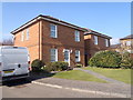
1
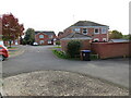
Cross Waters Close
A housing estate in Wootton Fields which is a suburb of Northampton.
Image: © Malcolm Neal
Taken: 14 Oct 2020
0.15 miles
2
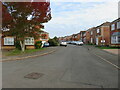
Cross Waters Close
A view up a further part of Cross Waters Close in Wootton Fields, Northampton. A suburb that has been there for some 30 years or so.
Image: © Malcolm Neal
Taken: 14 Oct 2020
0.15 miles
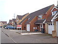
3
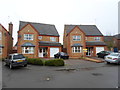
Hocknell Close
1990s houses in Wootton Fields.
Image: © Burgess Von Thunen
Taken: 8 Jan 2015
0.19 miles
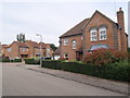
4
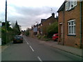
Water Lane
A mix of cottages and modern houses.
Image: © Burgess Von Thunen
Taken: 8 Apr 2011
0.20 miles
5
Edwardian Close
1990s houses in Wootton.
Image: © Burgess Von Thunen
Taken: 17 Mar 2016
0.22 miles
6
Crossbrooks
1990s houses in Wootton Fields.
Image: © Burgess Von Thunen
Taken: 29 Mar 2016
0.23 miles
7
Battalion Drive
1990s houses on Simpson Manor.
Image: © Burgess Von Thunen
Taken: 15 Jul 2015
0.23 miles
8
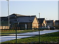
Wootton Community and Sports Centre
A bright and frosty morning.
Image: © Kokai
Taken: 29 Jan 2006
0.24 miles
9
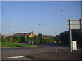
Roundabout on Newport Pagnell Road, Wootton
Image: © David Howard
Taken: 8 Aug 2012
0.24 miles