IMAGES TAKEN NEAR TO
Kings Close, NORTHAMPTON, NN4 5AH
Introduction
This page details the photographs taken nearby to Kings Close, NN4 5AH by members of the Geograph project.
The Geograph project started in 2005 with the aim of publishing, organising and preserving representative images for every square kilometre of Great Britain, Ireland and the Isle of Man.

There are currently over 7.5m images from over14,400 individuals and you can help contribute to the project by visiting https://www.geograph.org.uk
Image Map
Images are licensed for reuse under creativecommons.org/licenses/by-sa/2.0
Notes
- Clicking on the map will re-center to the selected point.
- The higher the marker number, the further away the image location is from the centre of the postcode.
Image Listing (27 Images Found)
Images are licensed for reuse under creativecommons.org/licenses/by-sa/2.0
Image
Details
Distance
1
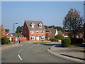
Quintonside
2000s detached houses in Grange Park.
Image: © Burgess Von Thunen
Taken: 9 Sep 2014
0.04 miles
2
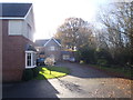
Barn Close
2000s houses in Grange Park.
Image: © Burgess Von Thunen
Taken: 4 Dec 2015
0.08 miles
3
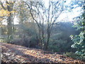
Bridge Meadow
Meadow on the edge of Grange Park.
Image: © Burgess Von Thunen
Taken: 4 Dec 2015
0.08 miles
4
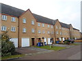
Brook View
2000s houses in Grange Park.
Image: © Burgess Von Thunen
Taken: 22 Jan 2015
0.10 miles
5
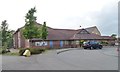
Grange Park Community Centre, School Lane
Part of the new suburban village of Grange Park, alongside junction 15 of the M1.
Image: © Christine Johnstone
Taken: 15 Jun 2013
0.10 miles
6
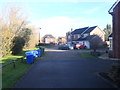
Barn Close
2000s houses in Grange Park.
Image: © Burgess Von Thunen
Taken: 4 Dec 2015
0.11 miles
7
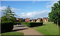
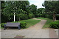
The Green, Grange Park
East of the primary school.
Image: © Christine Johnstone
Taken: 15 Jun 2013
0.11 miles
8
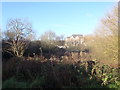
Bridge Meadow
Meadow on the edge of Grange Park.
Image: © Burgess Von Thunen
Taken: 4 Dec 2015
0.11 miles
10
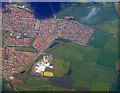
Caroline Chisholm School from the air
On the outskirts of Wootton. More information from this http://www.ccs.northants.sch.uk/
Image: © Thomas Nugent
Taken: 9 May 2011
0.12 miles