IMAGES TAKEN NEAR TO
Rosemoor Drive, NORTHAMPTON, NN4 0XD
Introduction
This page details the photographs taken nearby to Rosemoor Drive, NN4 0XD by members of the Geograph project.
The Geograph project started in 2005 with the aim of publishing, organising and preserving representative images for every square kilometre of Great Britain, Ireland and the Isle of Man.

There are currently over 7.5m images from over14,400 individuals and you can help contribute to the project by visiting https://www.geograph.org.uk
Image Map
Images are licensed for reuse under creativecommons.org/licenses/by-sa/2.0
Notes
- Clicking on the map will re-center to the selected point.
- The higher the marker number, the further away the image location is from the centre of the postcode.
Image Listing (17 Images Found)
Images are licensed for reuse under creativecommons.org/licenses/by-sa/2.0
Image
Details
Distance
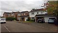
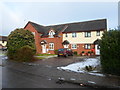
1
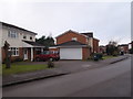
Rosemoor Drive
1990s houses in Blacky More.
Image: © Burgess Von Thunen
Taken: 27 Nov 2015
0.02 miles
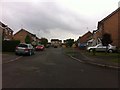
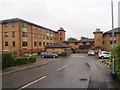
2
Lambrook Drive
1980s houses in Blacky More.
Image: © Burgess Von Thunen
Taken: 12 Mar 2014
0.09 miles
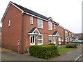
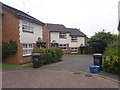
3
Granary Road
1980s houses in Blacky More.
Image: © Burgess Von Thunen
Taken: 27 Aug 2015
0.09 miles
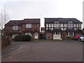
4
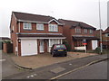
Granary Road
1980s houses in Blacky More.
Image: © Burgess Von Thunen
Taken: 26 Nov 2015
0.09 miles
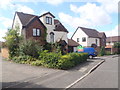
5
Wakehurst Drive
1980s houses in Blacky More
Image: © Burgess Von Thunen
Taken: 12 Oct 2018
0.10 miles
6
Lambrook Drive
1980s houses in Blacky More.
Image: © Burgess Von Thunen
Taken: 22 Aug 2013
0.10 miles
7
Granary Road
1980s semis in Blacky More.
Image: © Burgess Von Thunen
Taken: 10 Jun 2016
0.12 miles
8
Granary Road
1980s semis and a mattress in Blacky More.
Image: © Burgess Von Thunen
Taken: 17 Mar 2016
0.13 miles
9
The Weavers
1980s houses in Blacky More.
Image: © Burgess Von Thunen
Taken: 3 Feb 2015
0.19 miles
10
King Richard Court
1980s retirement flats in Blacky More.
Image: © Burgess Von Thunen
Taken: 21 Sep 2015
0.19 miles