IMAGES TAKEN NEAR TO
Cinnamon Close, NORTHAMPTON, NN4 0TU
Introduction
This page details the photographs taken nearby to Cinnamon Close, NN4 0TU by members of the Geograph project.
The Geograph project started in 2005 with the aim of publishing, organising and preserving representative images for every square kilometre of Great Britain, Ireland and the Isle of Man.

There are currently over 7.5m images from over14,400 individuals and you can help contribute to the project by visiting https://www.geograph.org.uk
Image Map
Images are licensed for reuse under creativecommons.org/licenses/by-sa/2.0
Notes
- Clicking on the map will re-center to the selected point.
- The higher the marker number, the further away the image location is from the centre of the postcode.
Image Listing (17 Images Found)
Images are licensed for reuse under creativecommons.org/licenses/by-sa/2.0
Image
Details
Distance
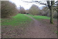
1
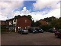
Shard Close
1980s houses in Blacky More.
Image: © Burgess Von Thunen
Taken: 15 Aug 2013
0.08 miles
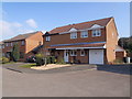
2
Peppercorn Way
1980s houses in Blacky More.
Image: © Burgess Von Thunen
Taken: 23 Oct 2015
0.09 miles
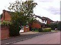
3
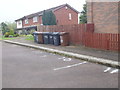
Get orf my laand!
People getting territorial over parking rights in Blacky More. I wonder if there's a camera in one of those bins.
Image: © Burgess Von Thunen
Taken: 11 May 2016
0.09 miles
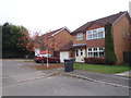
4
Brashland Drive
1980s houses in Blacky More.
Image: © Burgess Von Thunen
Taken: 22 Aug 2013
0.13 miles
6
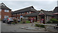
Travelodge motel
A Travelodge on the outskirts of Northampton.
Image: © Peter Mackenzie
Taken: 11 May 2019
0.16 miles
7
Wildern Lane
1980s houses in Collingtree Park.
Image: © Burgess Von Thunen
Taken: 12 Aug 2013
0.16 miles
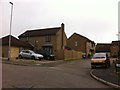
8
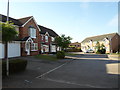
Butts Croft Close
1980s houses in Blacky More.
Image: © Burgess Von Thunen
Taken: 5 Sep 2013
0.16 miles
9
Oakgrove Place
1980s houses in Blacky More.
Image: © Burgess Von Thunen
Taken: 17 Mar 2016
0.18 miles
10
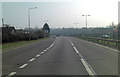
A45 junction with Wootton ring road
The slip road on the left leads to Wooldale Road which circles the southeastern quadrant of Wootton. Berry lane is also accessible from here.
Image: © Stuart Logan
Taken: 23 Mar 2012
0.18 miles