
IMAGES TAKEN NEAR TO
Hilliers Drive, NN4 0AL
Introduction
This page details the photographs taken nearby to Hilliers Drive, NN4 0AL by members of the Geograph project.
The Geograph project started in 2005 with the aim of publishing, organising and preserving representative images for every square kilometre of Great Britain, Ireland and the Isle of Man.

There are currently over 7.5m images from over14,400 individuals and you can help contribute to the project by visiting https://www.geograph.org.uk
Image Map
Images are licensed for reuse under creativecommons.org/licenses/by-sa/2.0
Notes
- Clicking on the map will re-center to the selected point.
- The higher the marker number, the further away the image location is from the centre of the postcode.
Image Listing (13 Images Found)
Images are licensed for reuse under creativecommons.org/licenses/by-sa/2.0
Image
Details
Distance
1
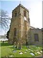
Collingtree, tower
The C15 tower of St. Columba's: http://www.imagesofengland.org.uk/Details/Default.aspx?id=232093&mode=adv
Image: © Mike Faherty
Taken: 7 May 2016
0.13 miles
2
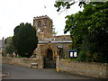
Collingtree
The Parish Church of Saint Columba.
Image: © Ian Rob
Taken: 16 May 2007
0.14 miles
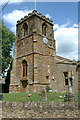
4
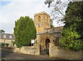
Collingtree: The Church of St Columba
Parts of the church are said to date back to the early 12th century, although it has been extended and restored several times. The church is a Grade II* Listed Building. Anglican churches in England dedicated to St Columba are few in number, although there are several in Scotland and several Roman Catholic ones around.
Image: © Nigel Cox
Taken: 20 Oct 2013
0.14 miles
5
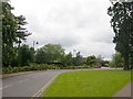
Northampton-Collingtree
The Clubhouse at Collingtree Park Golf Course.
Image: © Ian Rob
Taken: 16 May 2007
0.16 miles
6
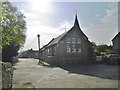
Collingtree, school
Collingtree C. of E. Primary School, at the corner of High Street and Sargeants Lane. The building is dated 1881. http://www.collingtree.northants.sch.uk/
Image: © Mike Faherty
Taken: 7 May 2016
0.16 miles
7
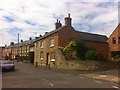
High Street
Houses in Collingtree.
Image: © Burgess Von Thunen
Taken: 1 Jun 2013
0.16 miles
8
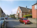
Collingtree Village Hall
On High Street; dated 1896.
Image: © Mike Faherty
Taken: 7 May 2016
0.19 miles
9
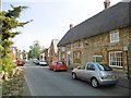
Collingtree, Wooden Walls of Old England
Thatched pub on High Street, named in honour of the Royal Navy; internally, two rooms, garden, TV, background music; exposed stonework. Cask ales on offer at my visit: Brakspear Gold, Jennings Cumberland, Thwaites Wainwright. The building is listed by Historic England: http://www.imagesofengland.org.uk/Details/Default.aspx?id=232098&mode=adv
Image: © Mike Faherty
Taken: 7 May 2016
0.19 miles
10
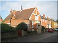
Collingtree: Former County Library
The photographer writes "County Library" as a rather attractive old Northamptonshire sign adorns the building, but "former" because it is not shown on the current online list of libraries.
Image: © Nigel Cox
Taken: 20 Oct 2013
0.20 miles