IMAGES TAKEN NEAR TO
Prentice Court, NORTHAMPTON, NN3 8XS
Introduction
This page details the photographs taken nearby to Prentice Court, NN3 8XS by members of the Geograph project.
The Geograph project started in 2005 with the aim of publishing, organising and preserving representative images for every square kilometre of Great Britain, Ireland and the Isle of Man.

There are currently over 7.5m images from over14,400 individuals and you can help contribute to the project by visiting https://www.geograph.org.uk
Image Map
Images are licensed for reuse under creativecommons.org/licenses/by-sa/2.0
Notes
- Clicking on the map will re-center to the selected point.
- The higher the marker number, the further away the image location is from the centre of the postcode.
Image Listing (11 Images Found)
Images are licensed for reuse under creativecommons.org/licenses/by-sa/2.0
Image
Details
Distance
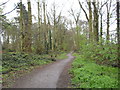
1
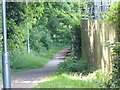
Goldings
Paths in the Eastern District.
Image: © Burgess Von Thunen
Taken: 16 May 2016
0.08 miles
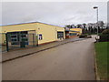
2
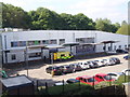
Greenfields Specialist School for Communications
A school in Goldings.
Image: © Burgess Von Thunen
Taken: 16 May 2016
0.08 miles
3
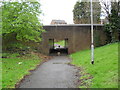
Goldings
An underpass under Goldings Road.
Image: © Burgess Von Thunen
Taken: 9 Apr 2012
0.09 miles
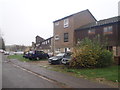
4
Crestline Court
1970s council flats in Goldings.
Image: © Burgess Von Thunen
Taken: 6 May 2016
0.11 miles
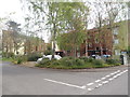
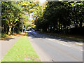
5
Lings Wood
Between Goldings and Lings.
Image: © Burgess Von Thunen
Taken: 9 Apr 2012
0.14 miles
6
Dryleys Court
1970s council houses in Goldings.
Image: © Burgess Von Thunen
Taken: 17 Nov 2015
0.17 miles
8
Shelford Close
1980s houses in The Glades.
Image: © Burgess Von Thunen
Taken: 29 Sep 2015
0.19 miles
9
Woodvale Primary Academy
In Lings.
Image: © Burgess Von Thunen
Taken: 22 Dec 2015
0.21 miles
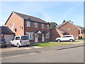
10
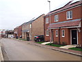
Crestwood Close
New houses in Crestwood Gardens.
Image: © Burgess Von Thunen
Taken: 22 Dec 2015
0.24 miles