
IMAGES TAKEN NEAR TO
Sedgwick Court, NORTHAMPTON, NN3 8HR
Introduction
This page details the photographs taken nearby to Sedgwick Court, NN3 8HR by members of the Geograph project.
The Geograph project started in 2005 with the aim of publishing, organising and preserving representative images for every square kilometre of Great Britain, Ireland and the Isle of Man.

There are currently over 7.5m images from over14,400 individuals and you can help contribute to the project by visiting https://www.geograph.org.uk
Image Map
Images are licensed for reuse under creativecommons.org/licenses/by-sa/2.0
Notes
- Clicking on the map will re-center to the selected point.
- The higher the marker number, the further away the image location is from the centre of the postcode.
Image Listing (13 Images Found)
Images are licensed for reuse under creativecommons.org/licenses/by-sa/2.0
Image
Details
Distance
1
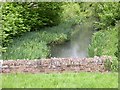
North End of Dragonfly Lake
The lake was officially named in 2003 by 'Friends of the Lakes', part of the 'Greener Cleaner Campaign' - a partnership between Northampton Borough Council and the Chronicle and Echo, a local newspaper.
Image: © Kokai
Taken: 23 May 2006
0.13 miles
2
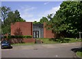
Brookside Community Centre
At Brookside Shopping Centre.
Image: © Kokai
Taken: 23 May 2006
0.15 miles
4
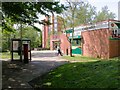
Brookside Shopping Centre
A very compact set of facilities. Costcutter in the foreground is the Post Office, Supermarket and Newsagent. Behind it is a Chinese Takeaway that also sells fish and chips. There is also a pub, the Mill Wheel, opposite and the Community Centre is close by.
Image: © Kokai
Taken: 23 May 2006
0.20 miles
5
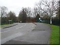
Birds Hill Walk
Service access to Northampton Academy.
Image: © Burgess Von Thunen
Taken: 9 Apr 2012
0.20 miles
6
Flaxlands Court
1070s council houses in Lings.
Image: © Burgess Von Thunen
Taken: 18 Jan 2019
0.20 miles
7
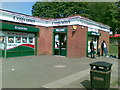
Costcutter, Billing Brook Road, Northampton
Image: © Alex McGregor
Taken: 2 Sep 2010
0.21 miles
8
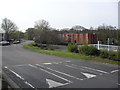
Billing Brook Road
Speed bumps in Lings.
Image: © Burgess Von Thunen
Taken: 14 Apr 2012
0.21 miles
10
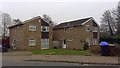
Rickyard Road
1980s houses in The Arbours.
Image: © Burgess Von Thunen
Taken: 10 Jan 2019
0.23 miles