IMAGES TAKEN NEAR TO
Moulton Way North, NORTHAMPTON, NN3 7RW
Introduction
This page details the photographs taken nearby to Moulton Way North, NN3 7RW by members of the Geograph project.
The Geograph project started in 2005 with the aim of publishing, organising and preserving representative images for every square kilometre of Great Britain, Ireland and the Isle of Man.

There are currently over 7.5m images from over14,400 individuals and you can help contribute to the project by visiting https://www.geograph.org.uk
Image Map
Images are licensed for reuse under creativecommons.org/licenses/by-sa/2.0
Notes
- Clicking on the map will re-center to the selected point.
- The higher the marker number, the further away the image location is from the centre of the postcode.
Image Listing (9 Images Found)
Images are licensed for reuse under creativecommons.org/licenses/by-sa/2.0
Image
Details
Distance
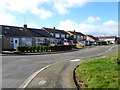
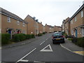
1
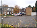
Russell Square
1970s houses in Moulton Leys.
Image: © Burgess Von Thunen
Taken: 30 Oct 2015
0.07 miles
2
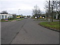
Moulton Park
Moulton Park is no longer parkland of the local country manor but is now an industrial estate.
Image: © Michael Patterson
Taken: 15 Dec 2006
0.13 miles
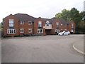
3
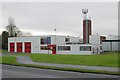
Moulton fire station
Moulton fire station, Moulton Way, Northampton, Northamptonshire
Image: © Kevin Hale
Taken: 4 Dec 2007
0.17 miles
4
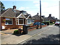
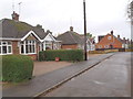
Boughton Lane
1930s bungalows in Moulton.
Image: © Burgess Von Thunen
Taken: 7 Aug 2014
0.18 miles
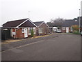
5
Northampton Lane South
1950s bungalows in Moulton.
Image: © Burgess Von Thunen
Taken: 29 Oct 2015
0.19 miles
6
Cedar Gate
2000s flats in Moulton Leys.
Image: © Burgess Von Thunen
Taken: 13 Oct 2015
0.20 miles
7
Oundle Drive
1070s houses in Moulton.
Image: © Burgess Von Thunen
Taken: 4 Mar 2014
0.22 miles
8
Oundle Drive
1970s bungalows in Moulton.
Image: © Burgess Von Thunen
Taken: 17 Nov 2015
0.23 miles
9
Brad Street
2000s houses in Moulton Park.
Image: © Burgess Von Thunen
Taken: 21 Nov 2014
0.25 miles