IMAGES TAKEN NEAR TO
Kendal Close, NORTHAMPTON, NN3 6WJ
Introduction
This page details the photographs taken nearby to Kendal Close, NN3 6WJ by members of the Geograph project.
The Geograph project started in 2005 with the aim of publishing, organising and preserving representative images for every square kilometre of Great Britain, Ireland and the Isle of Man.

There are currently over 7.5m images from over14,400 individuals and you can help contribute to the project by visiting https://www.geograph.org.uk
Image Map
Images are licensed for reuse under creativecommons.org/licenses/by-sa/2.0
Notes
- Clicking on the map will re-center to the selected point.
- The higher the marker number, the further away the image location is from the centre of the postcode.
Image Listing (20 Images Found)
Images are licensed for reuse under creativecommons.org/licenses/by-sa/2.0
Image
Details
Distance
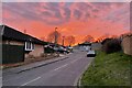
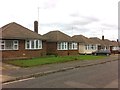
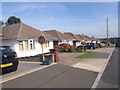
2
Woodside Avenue
1950s bungalows in Boothville. The sign on the lamp post says this is a No Cold Calling Area.
Image: © Burgess Von Thunen
Taken: 26 Oct 2013
0.11 miles
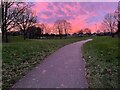
4
The Arbours
Open space behind Woodside Avenue.
Image: © Burgess Von Thunen
Taken: 26 Oct 2013
0.13 miles
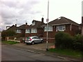
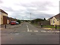
5
Greenway Avenue
1950s bungalows in Boothville.
Image: © Burgess Von Thunen
Taken: 26 Oct 2013
0.13 miles
7
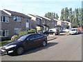
Esher Court
1980s semis in The Arbours.
Image: © Burgess Von Thunen
Taken: 12 Aug 2015
0.15 miles
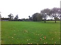
8
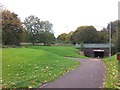
The Arbours
Footpath leading under Lumbertubs Way to Thorplands.
Image: © Burgess Von Thunen
Taken: 26 Oct 2013
0.16 miles
9
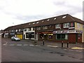
Boothville Green
Boothville Fish Bar, Mason Avenue, The Delicious Takeaway and New Sage.
Image: © Burgess Von Thunen
Taken: 26 Oct 2013
0.16 miles
10
Queenswood Avenue
1950s bungalows in Boothville.
Image: © Burgess Von Thunen
Taken: 29 Sep 2015
0.18 miles