IMAGES TAKEN NEAR TO
Kettering Road, NORTHAMPTON, NN3 6QX
Introduction
This page details the photographs taken nearby to Kettering Road, NN3 6QX by members of the Geograph project.
The Geograph project started in 2005 with the aim of publishing, organising and preserving representative images for every square kilometre of Great Britain, Ireland and the Isle of Man.

There are currently over 7.5m images from over14,400 individuals and you can help contribute to the project by visiting https://www.geograph.org.uk
Image Map
Images are licensed for reuse under creativecommons.org/licenses/by-sa/2.0
Notes
- Clicking on the map will re-center to the selected point.
- The higher the marker number, the further away the image location is from the centre of the postcode.
Image Listing (39 Images Found)
Images are licensed for reuse under creativecommons.org/licenses/by-sa/2.0
Image
Details
Distance
1
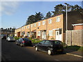
Eden Close
Council houses in Boothville.
Image: © Burgess Von Thunen
Taken: 13 Jan 2013
0.02 miles
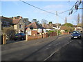
2
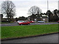
Spinney Hill
Junction of Churchill Avenue and Kettering Road.
Image: © Burgess Von Thunen
Taken: 21 Dec 2012
0.05 miles
3
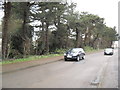
Spinney Hill
Pine trees off Becket Way.
Image: © Burgess Von Thunen
Taken: 21 Dec 2012
0.06 miles
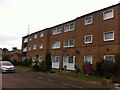
4
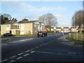
Boothville
Maisonettes on the corner of Churchill Avenue and Eden Close.
Image: © Burgess Von Thunen
Taken: 13 Jan 2013
0.06 miles
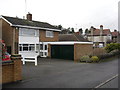
5
Macmillan Way
Council flats in Spinney Hill.
Image: © Burgess Von Thunen
Taken: 20 Jul 2013
0.08 miles
6
Glenville
Houses in Spinney Hill.
Image: © Burgess Von Thunen
Taken: 21 Dec 2012
0.09 miles
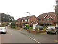
7
Macmillan Way
1990s detached houses in Spinney Hill.
Image: © Burgess Von Thunen
Taken: 20 Jul 2013
0.10 miles
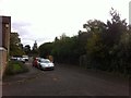
8
Shap Green
Shap Green borders the rear of properties fronting onto Kettering Road.
Image: © Burgess Von Thunen
Taken: 26 Oct 2013
0.11 miles
9
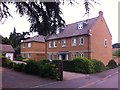
Manderville Close
2000s houses in Manfield Grange.
Image: © Burgess Von Thunen
Taken: 10 Jul 2013
0.11 miles
10
Glenville
Houses in Spinney Hill.
Image: © Burgess Von Thunen
Taken: 13 Jan 2013
0.12 miles