IMAGES TAKEN NEAR TO
Kettering Road, NORTHAMPTON, NN3 6QH
Introduction
This page details the photographs taken nearby to Kettering Road, NN3 6QH by members of the Geograph project.
The Geograph project started in 2005 with the aim of publishing, organising and preserving representative images for every square kilometre of Great Britain, Ireland and the Isle of Man.

There are currently over 7.5m images from over14,400 individuals and you can help contribute to the project by visiting https://www.geograph.org.uk
Image Map
Images are licensed for reuse under creativecommons.org/licenses/by-sa/2.0
Notes
- Clicking on the map will re-center to the selected point.
- The higher the marker number, the further away the image location is from the centre of the postcode.
Image Listing (55 Images Found)
Images are licensed for reuse under creativecommons.org/licenses/by-sa/2.0
Image
Details
Distance
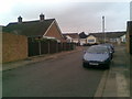
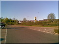
1
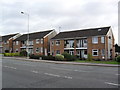
Kettering Road
1970s maisonettes in Spinney Hill.
Image: © Burgess Von Thunen
Taken: 10 Oct 2011
0.02 miles
2
Laburnum Crescent
1960s houses in Spinney Hill.
Image: © Burgess Von Thunen
Taken: 10 Oct 2011
0.04 miles
3
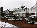
Kettering Road
Houses in Spinney Hill.
Image: © Burgess Von Thunen
Taken: 23 Mar 2013
0.04 miles
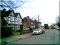
4
The Avenue
1930s houses in Spinney Hill.
Image: © Burgess Von Thunen
Taken: 10 Oct 2011
0.07 miles
5
Laburnum Crescent
1960s bungalows in Spinney Hill.
Image: © Burgess Von Thunen
Taken: 10 Aug 2010
0.08 miles
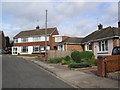
6
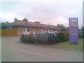
Nu Nu
A day nursery in Spinney Hill.
Image: © Burgess Von Thunen
Taken: 29 Jul 2011
0.08 miles
7
Greenfield Avenue
1930s houses in Spinney Hill.
Image: © Burgess Von Thunen
Taken: 28 Feb 2011
0.09 miles
8
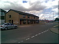
Beech Avenue
1970s maisonettes in Spinney Hill.
Image: © Burgess Von Thunen
Taken: 21 Jul 2010
0.09 miles
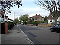
10
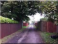
Spinney Hill
Alleyway between Kettering Road and Mountfield Road.
Image: © Burgess Von Thunen
Taken: 24 Sep 2013
0.10 miles