IMAGES TAKEN NEAR TO
Woodcote Avenue, NORTHAMPTON, NN3 6DU
Introduction
This page details the photographs taken nearby to Woodcote Avenue, NN3 6DU by members of the Geograph project.
The Geograph project started in 2005 with the aim of publishing, organising and preserving representative images for every square kilometre of Great Britain, Ireland and the Isle of Man.

There are currently over 7.5m images from over14,400 individuals and you can help contribute to the project by visiting https://www.geograph.org.uk
Image Map
Images are licensed for reuse under creativecommons.org/licenses/by-sa/2.0
Notes
- Clicking on the map will re-center to the selected point.
- The higher the marker number, the further away the image location is from the centre of the postcode.
Image Listing (18 Images Found)
Images are licensed for reuse under creativecommons.org/licenses/by-sa/2.0
Image
Details
Distance
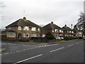
1
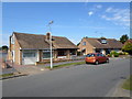
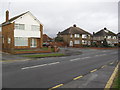
Coppice Drive
1960s semis in Parklands.
Image: © Burgess Von Thunen
Taken: 5 Sep 2013
0.06 miles
2
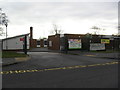
Parklands
Parklands Primary School.
Image: © Burgess Von Thunen
Taken: 21 Dec 2012
0.10 miles
3
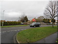
Parklands
A Ford Focus at the junction of Coppice Drive, Spinney Hill Road and Ledaig Way.
Image: © Burgess Von Thunen
Taken: 21 Dec 2012
0.10 miles
4
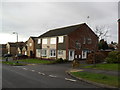
Spinney Hill Road
1970s maisonettes in Parklands.
Image: © Burgess Von Thunen
Taken: 21 Dec 2012
0.12 miles
5
Parklands
Junction of Parklands Avenue and Spinney Hill Road.
Image: © Burgess Von Thunen
Taken: 21 Dec 2012
0.14 miles
6
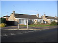
Ledaig Way
1960s bungalows in Parklands.
Image: © Burgess Von Thunen
Taken: 13 Jan 2013
0.15 miles
7
Highlands Avenue
1960s bungalows in Spinney Hill.
Image: © Burgess Von Thunen
Taken: 17 Mar 2014
0.19 miles
8
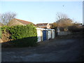
Spinney Hill
Garages behind Spinney Hill Road.
Image: © Burgess Von Thunen
Taken: 13 Jan 2013
0.19 miles
9
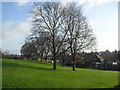
Parklands Primary School
Trees in the playing field.
Image: © Burgess Von Thunen
Taken: 13 Jan 2013
0.20 miles
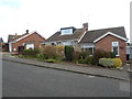
10
Spinney Hill Road
1930s semis in Spinney Hill.
Image: © Burgess Von Thunen
Taken: 21 Dec 2012
0.20 miles