IMAGES TAKEN NEAR TO
Cherry Close, NORTHAMPTON, NN3 2TQ
Introduction
This page details the photographs taken nearby to Cherry Close, NN3 2TQ by members of the Geograph project.
The Geograph project started in 2005 with the aim of publishing, organising and preserving representative images for every square kilometre of Great Britain, Ireland and the Isle of Man.

There are currently over 7.5m images from over14,400 individuals and you can help contribute to the project by visiting https://www.geograph.org.uk
Image Map
Images are licensed for reuse under creativecommons.org/licenses/by-sa/2.0
Notes
- Clicking on the map will re-center to the selected point.
- The higher the marker number, the further away the image location is from the centre of the postcode.
Image Listing (16 Images Found)
Images are licensed for reuse under creativecommons.org/licenses/by-sa/2.0
Image
Details
Distance
1
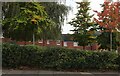
New houses on Birchfield Road East, Northampton
These were built by Bellway in 2012
Image: © David Howard
Taken: 9 Oct 2022
0.07 miles
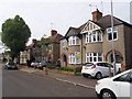
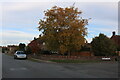
2
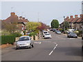
The Headlands
Crossroads of Bush Hill and Birchfield Road East.
Image: © Burgess Von Thunen
Taken: 9 May 2016
0.07 miles
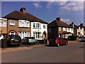
3
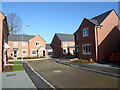
Cherry Orchard Place
2010s houses in Weston Favell.
Image: © Burgess Von Thunen
Taken: 26 Feb 2014
0.08 miles
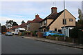
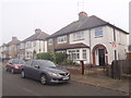
5
Bush Hill
1930s semis in The Headlands.
Image: © Burgess Von Thunen
Taken: 9 May 2016
0.11 miles
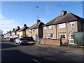
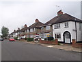
6
The Headlands
1930s semis in the eponymously-named Headlands.
Image: © Burgess Von Thunen
Taken: 7 Jul 2013
0.15 miles
7
The Headlands
1930s semis in The Headlands.
Image: © Burgess Von Thunen
Taken: 2 Nov 2015
0.15 miles
8
The Headlands
1930s semis in The Headlands.
Image: © Burgess Von Thunen
Taken: 30 Mar 2016
0.15 miles
9
Birchfield Road East at the junction of Hervey Close
Image: © David Howard
Taken: 9 Oct 2022
0.16 miles
10
The Headlands
1930s semis in The Headlands.
Image: © Burgess Von Thunen
Taken: 11 May 2016
0.16 miles