IMAGES TAKEN NEAR TO
Broadway East, NORTHAMPTON, NN3 2PP
Introduction
This page details the photographs taken nearby to Broadway East, NN3 2PP by members of the Geograph project.
The Geograph project started in 2005 with the aim of publishing, organising and preserving representative images for every square kilometre of Great Britain, Ireland and the Isle of Man.

There are currently over 7.5m images from over14,400 individuals and you can help contribute to the project by visiting https://www.geograph.org.uk
Image Map (66 Images)


Leaflet Map data © OpenStreetMap
Images are licensed for reuse under creativecommons.org/licenses/by-sa/2.0
Notes
- Clicking on the map will re-center to the selected point.
- The higher the marker number, the further away the image location is from the centre of the postcode.
Image Listing (66 Images Found)
Images are licensed for reuse under creativecommons.org/licenses/by-sa/2.0
Image
Details
Distance
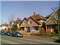
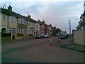
1
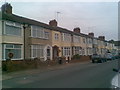
Broadway East
Edwardian houses in Abington.
Image: © Burgess Von Thunen
Taken: 4 Jul 2011
0.04 miles
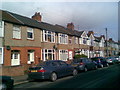
2
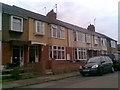
Linden Road
Edwardian houses in Abington.
Image: © Burgess Von Thunen
Taken: 4 Jul 2011
0.04 miles
3
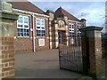
Cedar Road School
A 1930s primary school.
Image: © Burgess Von Thunen
Taken: 17 Mar 2010
0.05 miles
4
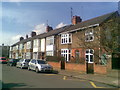
Cedar Road East
Edwardian terraced houses.
Image: © Burgess Von Thunen
Taken: 25 Mar 2010
0.06 miles
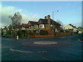
5
Park Avenue North
1930s semis in Abington.
Image: © Burgess Von Thunen
Taken: 4 Mar 2011
0.07 miles
6
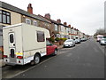
Cedar Road East
A camper van in Abington.
Image: © Burgess Von Thunen
Taken: 4 Apr 2014
0.08 miles
7
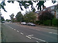
Park Avenue North
Nineteenth century houses on a main thoroughfare in Abington.
Image: © Burgess Von Thunen
Taken: 10 Aug 2010
0.09 miles
8
Park Avenue North
1930s houses in Abington.
Image: © Burgess Von Thunen
Taken: 1 Feb 2011
0.09 miles
9
Hawthorn Road
Inter-war houses in Abington.
Image: © Burgess Von Thunen
Taken: 4 Jul 2011
0.09 miles
10
Birchfield Road East
Edwardian terraced houses in Abington.
Image: © Burgess Von Thunen
Taken: 2 Nov 2010
0.11 miles