IMAGES TAKEN NEAR TO
Grange Road, NORTHAMPTON, NN3 2AZ
Introduction
This page details the photographs taken nearby to Grange Road, NN3 2AZ by members of the Geograph project.
The Geograph project started in 2005 with the aim of publishing, organising and preserving representative images for every square kilometre of Great Britain, Ireland and the Isle of Man.

There are currently over 7.5m images from over14,400 individuals and you can help contribute to the project by visiting https://www.geograph.org.uk
Image Map
Images are licensed for reuse under creativecommons.org/licenses/by-sa/2.0
Notes
- Clicking on the map will re-center to the selected point.
- The higher the marker number, the further away the image location is from the centre of the postcode.
Image Listing (13 Images Found)
Images are licensed for reuse under creativecommons.org/licenses/by-sa/2.0
Image
Details
Distance
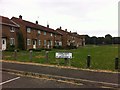
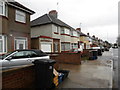
1
Broughton Place
1950s council houses in Eastfield.
Image: © Burgess Von Thunen
Taken: 20 Jul 2013
0.16 miles
2
Tarncroft
1950s council houses in Eastfield.
Image: © Burgess Von Thunen
Taken: 20 Jul 2013
0.17 miles
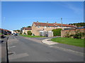
3
Broadmead Avenue
1950s council houses in Eastfield.
Image: © Burgess Von Thunen
Taken: 20 Jul 2013
0.18 miles
4
Greenfield Avenue
1950s council houses in Eastfield.
Image: © Burgess Von Thunen
Taken: 7 Sep 2014
0.20 miles
5
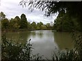
Eastfield Park
With a lake in the middle.
Image: © Burgess Von Thunen
Taken: 26 Oct 2013
0.20 miles
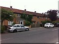
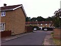
6
Bushland Road
1950s semis in The Headlands.
Image: © Burgess Von Thunen
Taken: 18 Mar 2014
0.21 miles
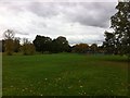
7
Eastfield Park
Basketball court.
Image: © Burgess Von Thunen
Taken: 20 Jul 2013
0.22 miles
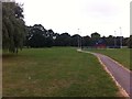
8
Eastfield Park
Playground and basketball court.
Image: © Burgess Von Thunen
Taken: 26 Oct 2013
0.22 miles
9
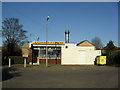
Eastfield Fish Bar
In Longland Road.
Image: © Burgess Von Thunen
Taken: 26 Mar 2012
0.23 miles
10
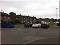
Eastfield
Parking for houses on Greenfield Avenue and Greenside.
Image: © Burgess Von Thunen
Taken: 21 Jul 2013
0.24 miles