
IMAGES TAKEN NEAR TO
Arkwright Road, WELLINGBOROUGH, NN29 7HD
Introduction
This page details the photographs taken nearby to Arkwright Road, NN29 7HD by members of the Geograph project.
The Geograph project started in 2005 with the aim of publishing, organising and preserving representative images for every square kilometre of Great Britain, Ireland and the Isle of Man.

There are currently over 7.5m images from over14,400 individuals and you can help contribute to the project by visiting https://www.geograph.org.uk
Image Map
Images are licensed for reuse under creativecommons.org/licenses/by-sa/2.0
Notes
- Clicking on the map will re-center to the selected point.
- The higher the marker number, the further away the image location is from the centre of the postcode.
Image Listing (18 Images Found)
Images are licensed for reuse under creativecommons.org/licenses/by-sa/2.0
Image
Details
Distance
1
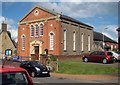
Irchester: Methodist Church
The church was built as a Wesleyan Chapel in 1869 and the bunting outside reflects the celebration of its 150th anniversary in 2019. The building to the rear is a later extension.
Image: © Nigel Cox
Taken: 14 Jun 2019
0.13 miles
4
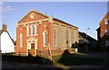
The Wesleyan Chapel
Built in 1879 in the village of Irchester.
Image: © Kokai
Taken: 24 Oct 2006
0.15 miles
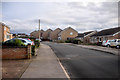
6
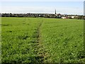
Footpath to Irchester
Crosses two fields between Station Road and the old part of the village.
Image: © Kokai
Taken: 9 Nov 2006
0.16 miles
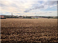
8
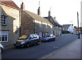
High Street, Irchester
Early evening in Autumn produces tall shadows here. The road to the left, past the thatched house on the corner, leads to Knuston Hall and Rushden Town.
Image: © Kokai
Taken: 24 Oct 2006
0.16 miles
10
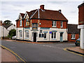
The 19th, Irchester High Street
Public house and restaurant on High Street. Previously called "The Red Lion".
Image: © David Dixon
Taken: 4 Sep 2016
0.17 miles