IMAGES TAKEN NEAR TO
Sutton Close, NORTHAMPTON, NN2 8PJ
Introduction
This page details the photographs taken nearby to Sutton Close, NN2 8PJ by members of the Geograph project.
The Geograph project started in 2005 with the aim of publishing, organising and preserving representative images for every square kilometre of Great Britain, Ireland and the Isle of Man.

There are currently over 7.5m images from over14,400 individuals and you can help contribute to the project by visiting https://www.geograph.org.uk
Image Map
Images are licensed for reuse under creativecommons.org/licenses/by-sa/2.0
Notes
- Clicking on the map will re-center to the selected point.
- The higher the marker number, the further away the image location is from the centre of the postcode.
Image Listing (11 Images Found)
Images are licensed for reuse under creativecommons.org/licenses/by-sa/2.0
Image
Details
Distance
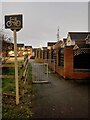
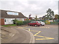
1

Holly Lodge Drive
On the edge of Obelisk Rise.
Image: © Burgess Von Thunen
Taken: 24 Jun 2014
0.04 miles
2
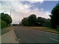
Holly Lodge Drive
With Obelisk Rise housing estate on the left, this road heads up to Moulton Park industrial estate.
Image: © Burgess Von Thunen
Taken: 15 Jul 2010
0.08 miles
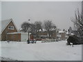
4
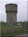
Water and Comms
This concrete water tower also doubles as a communication mast.
Image: © Michael Patterson
Taken: 15 Dec 2006
0.11 miles
5
Reynard Way
1070s houses next to Sunnyside school.
Image: © Burgess Von Thunen
Taken: 13 Oct 2015
0.13 miles
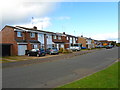
6
Hartwell Close
1960s houses in Kingsthorpe.
Image: © Burgess Von Thunen
Taken: 18 Jan 2013
0.13 miles
7
Falcutt Way
1970s semis in Kingsthorpe.
Image: © Burgess Von Thunen
Taken: 23 Oct 2013
0.19 miles
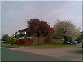
8

Obelisk Rise
1970s houses in Obelisk Rise.
Image: © Burgess Von Thunen
Taken: 25 Mar 2010
0.20 miles
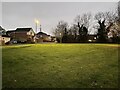
9
Reynard Way
1970s houses in Obelisk Rise.
Image: © Burgess Von Thunen
Taken: 24 Apr 2010
0.21 miles