IMAGES TAKEN NEAR TO
Anchor Drive, NORTHAMPTON, NN2 8LN
Introduction
This page details the photographs taken nearby to Anchor Drive, NN2 8LN by members of the Geograph project.
The Geograph project started in 2005 with the aim of publishing, organising and preserving representative images for every square kilometre of Great Britain, Ireland and the Isle of Man.

There are currently over 7.5m images from over14,400 individuals and you can help contribute to the project by visiting https://www.geograph.org.uk
Image Map
Images are licensed for reuse under creativecommons.org/licenses/by-sa/2.0
Notes
- Clicking on the map will re-center to the selected point.
- The higher the marker number, the further away the image location is from the centre of the postcode.
Image Listing (33 Images Found)
Images are licensed for reuse under creativecommons.org/licenses/by-sa/2.0
Image
Details
Distance
1
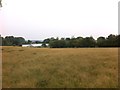
Kingsthorpe
A paddock off Harborough Road North.
Image: © Burgess Von Thunen
Taken: 23 Aug 2013
0.07 miles
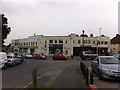
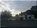
2
Shops on Harborough Road North, Northampton
Image: © David Howard
Taken: 2 Jul 2019
0.09 miles
3
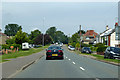
A508 Harborough Road North, Northampton
Heading north out of town.
Image: © Robin Webster
Taken: 23 Jun 2019
0.09 miles
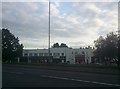
4
Whitehills Crescent
Premier Whitehills Supermarket, Post Office and Golden Hill in 1930s retail premises in Whitehills.
Image: © Burgess Von Thunen
Taken: 23 Aug 2013
0.10 miles
6
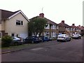
Lynton Avenue
Houses in Whitehills.
Image: © Burgess Von Thunen
Taken: 23 Aug 2013
0.10 miles
7
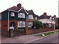
Sandhills Road
1930s semis in Whitehills.
Image: © Burgess Von Thunen
Taken: 23 Aug 2013
0.11 miles
8
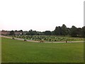
Kingsthorpe Cemetery
Used to be allotments.
Image: © Burgess Von Thunen
Taken: 23 Aug 2013
0.11 miles
9
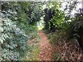
Public footpath to Northampton
From Boughton.
Image: © Burgess Von Thunen
Taken: 23 Aug 2013
0.11 miles
10
Tiverton Avenue
1930s houses in Kingsthorpe.
Image: © Burgess Von Thunen
Taken: 26 Apr 2017
0.12 miles