IMAGES TAKEN NEAR TO
Ruskin Road, NORTHAMPTON, NN2 7TA
Introduction
This page details the photographs taken nearby to Ruskin Road, NN2 7TA by members of the Geograph project.
The Geograph project started in 2005 with the aim of publishing, organising and preserving representative images for every square kilometre of Great Britain, Ireland and the Isle of Man.

There are currently over 7.5m images from over14,400 individuals and you can help contribute to the project by visiting https://www.geograph.org.uk
Image Map
Images are licensed for reuse under creativecommons.org/licenses/by-sa/2.0
Notes
- Clicking on the map will re-center to the selected point.
- The higher the marker number, the further away the image location is from the centre of the postcode.
Image Listing (19 Images Found)
Images are licensed for reuse under creativecommons.org/licenses/by-sa/2.0
Image
Details
Distance
1
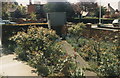
Boughton Green Road
From the corner of Helmdon Road. Date is approximate.
Image: © Stanley Chinn
Taken: Unknown
0.06 miles
2
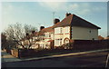
Boughton Green Road
View across the garden (and For Sale board) of No.129.
Date is approximate.
Image: © Stanley Chinn
Taken: Unknown
0.06 miles
3
Boughton Green Road, Kingsthorpe, Northampton
At Helmdon Road corner.
Image: © Chris
Taken: 21 Apr 2024
0.07 miles
4
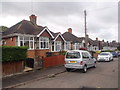
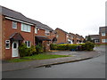
Ruskin Road
1930s bungalows in Kingsthorpe.
Image: © Burgess Von Thunen
Taken: 6 May 2015
0.09 miles
5
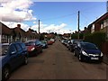
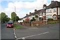
Ruskin Road
Bungalows and houses in Kingsthorpe.
Image: © Burgess Von Thunen
Taken: 11 Aug 2013
0.12 miles
6
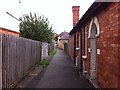
Public footpath to Ruskin Road
From Boughton Green Road.
Image: © Burgess Von Thunen
Taken: 11 Aug 2013
0.15 miles
7
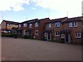
Bective Road
2000s houses in Kingsthorpe.
Image: © Burgess Von Thunen
Taken: 11 Aug 2013
0.16 miles
8
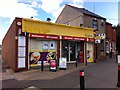
Krates
General store on Boughton Green Road.
Image: © Burgess Von Thunen
Taken: 11 Aug 2013
0.17 miles
9
Mill Meadow
1990s houses in Royal Park.
Image: © Burgess Von Thunen
Taken: 25 Mar 2014
0.17 miles
10
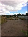
Bective Road School
Burnt down in 2010.
Image: © Burgess Von Thunen
Taken: 11 Aug 2013
0.18 miles