IMAGES TAKEN NEAR TO
Brookfield Road, NORTHAMPTON, NN2 7LT
Introduction
This page details the photographs taken nearby to Brookfield Road, NN2 7LT by members of the Geograph project.
The Geograph project started in 2005 with the aim of publishing, organising and preserving representative images for every square kilometre of Great Britain, Ireland and the Isle of Man.

There are currently over 7.5m images from over14,400 individuals and you can help contribute to the project by visiting https://www.geograph.org.uk
Image Map
Images are licensed for reuse under creativecommons.org/licenses/by-sa/2.0
Notes
- Clicking on the map will re-center to the selected point.
- The higher the marker number, the further away the image location is from the centre of the postcode.
Image Listing (9 Images Found)
Images are licensed for reuse under creativecommons.org/licenses/by-sa/2.0
Image
Details
Distance
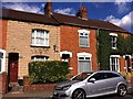
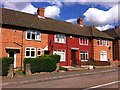
1
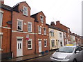
Lingfield Terrace
Terraced houses in Poets Corner.
Image: © Burgess Von Thunen
Taken: 24 Aug 2015
0.06 miles
2
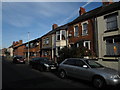
Chaucer Street
Terraced houses in Poets Corner.
Image: © Burgess Von Thunen
Taken: 13 Nov 2013
0.16 miles
3
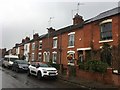
Chaucer Street
Victorian terraces in Poets' Corner.
Image: © Burgess Von Thunen
Taken: 24 Apr 2019
0.17 miles
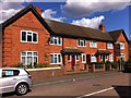
4
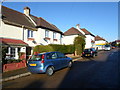
Malcolm Road
1930s council houses in Kingsley.
Image: © Burgess Von Thunen
Taken: 23 Jan 2014
0.18 miles
5
Byron Street
Victorian terraces in Poets Corner.
Image: © Burgess Von Thunen
Taken: 11 Aug 2013
0.18 miles
6
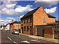
Junction Road
Converted Victorian factory in Poets Corner.
Image: © Burgess Von Thunen
Taken: 11 Aug 2013
0.19 miles
7
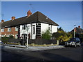
Kingsley
1930s council houses on the corner or Milton Street North and Randall Road.
Image: © Burgess Von Thunen
Taken: 26 Jan 2013
0.20 miles
8
Milton Street North
1930s council houses in Kingsley.
Image: © Burgess Von Thunen
Taken: 11 Aug 2013
0.21 miles
9
Milton Street North
1930s council houses in Kingsley.
Image: © Burgess Von Thunen
Taken: 11 Aug 2013
0.22 miles