IMAGES TAKEN NEAR TO
Auckland Close, NORTHAMPTON, NN2 7BJ
Introduction
This page details the photographs taken nearby to Auckland Close, NN2 7BJ by members of the Geograph project.
The Geograph project started in 2005 with the aim of publishing, organising and preserving representative images for every square kilometre of Great Britain, Ireland and the Isle of Man.

There are currently over 7.5m images from over14,400 individuals and you can help contribute to the project by visiting https://www.geograph.org.uk
Image Map
Images are licensed for reuse under creativecommons.org/licenses/by-sa/2.0
Notes
- Clicking on the map will re-center to the selected point.
- The higher the marker number, the further away the image location is from the centre of the postcode.
Image Listing (16 Images Found)
Images are licensed for reuse under creativecommons.org/licenses/by-sa/2.0
Image
Details
Distance
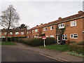
1
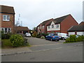
Auckland Close
2000s houses in Kingsthorpe.
Image: © Burgess Von Thunen
Taken: 5 Nov 2014
0.02 miles
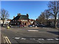
3
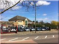
Kingsthorpe Golf Club
Clubhouse on Kingsley Road.
Image: © Burgess Von Thunen
Taken: 23 Apr 2013
0.11 miles
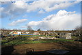
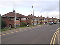
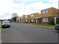
4
Eastern Avenue South
1950s council houses in St Davids.
Image: © Burgess Von Thunen
Taken: 12 Aug 2015
0.12 miles
5
Queensland Gardens
1950s council houses in St Davids.
Image: © Burgess Von Thunen
Taken: 23 Dec 2015
0.12 miles
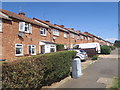
6
Fairway
1950s semis in Kingsley.
Image: © Burgess Von Thunen
Taken: 12 Nov 2015
0.15 miles
8
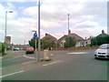
Kingsley Road
Mini-roundabout at the junction with Fairway.
Image: © Burgess Von Thunen
Taken: 19 May 2011
0.17 miles
9
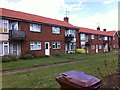
Kingsthorpe Grove
1950s council flats in St Davids.
Image: © Burgess Von Thunen
Taken: 11 Aug 2013
0.19 miles
10
Eastern Avenue South
1970s houses in Kingsthorpe.
Image: © Burgess Von Thunen
Taken: 10 Apr 2014
0.21 miles