
IMAGES TAKEN NEAR TO
Weldon Road, CORBY, NN17 5UE
Introduction
This page details the photographs taken nearby to Weldon Road, NN17 5UE by members of the Geograph project.
The Geograph project started in 2005 with the aim of publishing, organising and preserving representative images for every square kilometre of Great Britain, Ireland and the Isle of Man.

There are currently over 7.5m images from over14,400 individuals and you can help contribute to the project by visiting https://www.geograph.org.uk
Image Map
Images are licensed for reuse under creativecommons.org/licenses/by-sa/2.0
Notes
- Clicking on the map will re-center to the selected point.
- The higher the marker number, the further away the image location is from the centre of the postcode.
Image Listing (15 Images Found)
Images are licensed for reuse under creativecommons.org/licenses/by-sa/2.0
Image
Details
Distance
1
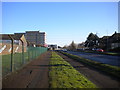
Footpath and cycle lane along Weldon Road, Corby
Passing through an industrial area east of the Old Village.
Image: © Richard Vince
Taken: 18 Jan 2020
0.03 miles
2
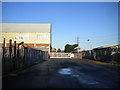
Entrance to industrial estate off Weldon Road, Corby
Image: © Richard Vince
Taken: 18 Jan 2020
0.05 miles
4
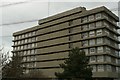
Office block
This was once the main admin office for the Stewart & Lloyds steelworks in Corby.
Image: © Blane Chalmers
Taken: 25 Feb 2007
0.13 miles
6
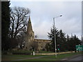
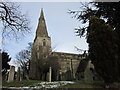
Church of Saint John the Baptist, 'Old' Corby
Centre of the village of Corby until the 1930s, when it became a steel boom-town
Image: © Tim Heaton
Taken: 28 Jan 2007
0.18 miles
7
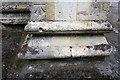
Benchmark on buttress of St John the Baptist Church tower
Ordnance Survey cut mark benchmark described on the Bench Mark Database at https://www.bench-marks.org.uk/bm100241
Image: © Roger Templeman
Taken: 13 Sep 2018
0.18 miles
8
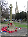
War memorial, 'Old' Corby
The wreaths are mainly from veterans associations. Church of Saint John the Baptist behind
Image: © Tim Heaton
Taken: 28 Jan 2007
0.19 miles
9
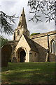
South face and spire of St John the Baptist Church
The spire in an Ordnance Survey intersected station trig point, http://trigpointing.uk/trig/11885
Image: © Roger Templeman
Taken: 13 Sep 2018
0.19 miles
10
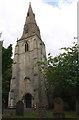
St John the Baptist Church
There is an OS benchmark Image on the buttress left of the tower door, and the spire is an OS intersected station trig point, http://trigpointing.uk/trig/11885
Image: © Roger Templeman
Taken: 13 Sep 2018
0.19 miles