
IMAGES TAKEN NEAR TO
Merlin Road, CORBY, NN17 5FQ
Introduction
This page details the photographs taken nearby to Merlin Road, NN17 5FQ by members of the Geograph project.
The Geograph project started in 2005 with the aim of publishing, organising and preserving representative images for every square kilometre of Great Britain, Ireland and the Isle of Man.

There are currently over 7.5m images from over14,400 individuals and you can help contribute to the project by visiting https://www.geograph.org.uk
Image Map
Images are licensed for reuse under creativecommons.org/licenses/by-sa/2.0
Notes
- Clicking on the map will re-center to the selected point.
- The higher the marker number, the further away the image location is from the centre of the postcode.
Image Listing (6 Images Found)
Images are licensed for reuse under creativecommons.org/licenses/by-sa/2.0
Image
Details
Distance
1
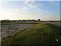
Development area, North East Corby
Image: © Jonathan Thacker
Taken: 28 Sep 2020
0.08 miles
2
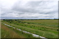
Looking over the central part of the Priors Hall Park development site
Some of the land for the new development is backfilled former ironstone workings, with possible subsidence concerns https://www.northantstelegraph.co.uk/news/building-halted-by-housing-company-after-foundation-issues-at-priors-hall-in-corby-1-7683433
Image: © Tim Heaton
Taken: 20 Jun 2018
0.21 miles
4
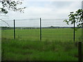
Corby Business Academy
School playing fields from Gretton Road.
Image: © Burgess Von Thunen
Taken: 29 May 2012
0.24 miles
5
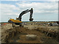
Industrial Development.
Major building work in progress on the outskirts of Corby.
Image: © Richard Williams
Taken: 22 May 2007
0.24 miles
6
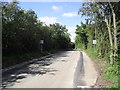
Gretton Road
Now with Passing Places.
Image: © Burgess Von Thunen
Taken: 31 Aug 2012
0.25 miles