IMAGES TAKEN NEAR TO
Falcon Road, CORBY, NN17 5FJ
Introduction
This page details the photographs taken nearby to Falcon Road, NN17 5FJ by members of the Geograph project.
The Geograph project started in 2005 with the aim of publishing, organising and preserving representative images for every square kilometre of Great Britain, Ireland and the Isle of Man.

There are currently over 7.5m images from over14,400 individuals and you can help contribute to the project by visiting https://www.geograph.org.uk
Image Map
Images are licensed for reuse under creativecommons.org/licenses/by-sa/2.0
Notes
- Clicking on the map will re-center to the selected point.
- The higher the marker number, the further away the image location is from the centre of the postcode.
Image Listing (10 Images Found)
Images are licensed for reuse under creativecommons.org/licenses/by-sa/2.0
Image
Details
Distance
1
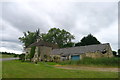
Weldon Lodge, Gretton Road,
Grade II listed farmhouse dating from the late 17th century https://historicengland.org.uk/listing/the-list/list-entry/1051776
Appears to be deserted - perhaps the constant din from the nearby Rockingham Motor Speedway was too much for the occupants
Image: © Tim Heaton
Taken: 20 Jun 2018
0.13 miles
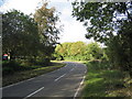
2
Gretton Road
On the edge of Corby.
Image: © Burgess Von Thunen
Taken: 25 May 2012
0.14 miles
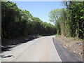
3
Gretton Road
View north as the road passes Weldon Lodge
Image: © Tim Heaton
Taken: 8 Oct 2006
0.15 miles
4
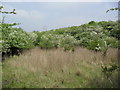
Corby
A disused quarry near Corby. There's a herd of deer in there somewhere but I was a bit slow with my camera.
Image: © Burgess Von Thunen
Taken: 24 May 2012
0.15 miles
5
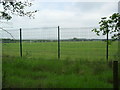
Corby Business Academy
School playing fields from Gretton Road.
Image: © Burgess Von Thunen
Taken: 29 May 2012
0.15 miles
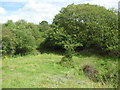
7
Corby
Evidence of old iron ore quarry workings.
Image: © Burgess Von Thunen
Taken: 21 May 2012
0.20 miles
8
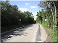
Gretton Road
Now with Passing Places.
Image: © Burgess Von Thunen
Taken: 31 Aug 2012
0.20 miles
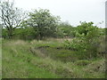
9
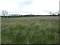
Corby
Disused land on the edge of town.
Image: © Burgess Von Thunen
Taken: 27 Apr 2012
0.22 miles
10
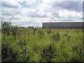
Morrisons
Disused land between an old quarry and a distribution depot.
Image: © Burgess Von Thunen
Taken: 24 Aug 2012
0.25 miles