
IMAGES TAKEN NEAR TO
Wakerley Road, CORBY, NN17 3AH
Introduction
This page details the photographs taken nearby to Wakerley Road, NN17 3AH by members of the Geograph project.
The Geograph project started in 2005 with the aim of publishing, organising and preserving representative images for every square kilometre of Great Britain, Ireland and the Isle of Man.

There are currently over 7.5m images from over14,400 individuals and you can help contribute to the project by visiting https://www.geograph.org.uk
Image Map
Images are licensed for reuse under creativecommons.org/licenses/by-sa/2.0
Notes
- Clicking on the map will re-center to the selected point.
- The higher the marker number, the further away the image location is from the centre of the postcode.
Image Listing (35 Images Found)
Images are licensed for reuse under creativecommons.org/licenses/by-sa/2.0
Image
Details
Distance
1
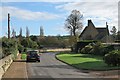
Harringworth: Wakerley Road
The fine 17th-century house on the right is Limes Farm - see http://www.britishlistedbuildings.co.uk/en-409506-limes-farmhouse-harringworth-northampton .
Image: © John Sutton
Taken: 25 Oct 2014
0.01 miles
2
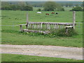
Equine jump
First look, I thought it was a rather large park bench in poor repair but then seeing the equine connection all was resolved.
Image: © Michael Trolove
Taken: 1 May 2009
0.02 miles
4
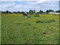
Horses on the Jurassic Way
The Jurassic Way crosses this field and approaches Harringworth on its 88 mile route from Stamford to Banbury. The spire and tower of St John the Baptist Church in Harringworth can be seen beyond the field.
Image: © Marathon
Taken: 24 May 2011
0.05 miles
5
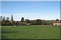
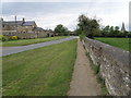
Harringworth: paddock and spire
A view from Wakerley Road. The viaduct shows beyond the village.
Image: © John Sutton
Taken: 25 Oct 2014
0.09 miles
6
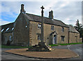
Harringworth: Market Cross and Cross Farmhouse
The cross is 14th-century, partially restored in 1837 - see http://www.britishlistedbuildings.co.uk/en-232987-market-cross-approximately-10-metres-nor . Behind it is a house with 17th-century origins, reworked in the 19th century - see http://www.britishlistedbuildings.co.uk/en-232988-cross-farmhouse-harringworth-northampton .
Image: © John Sutton
Taken: 25 Oct 2014
0.11 miles
7
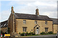
Market Cross and Cross Farmhouse, Deene Road, Harringworth
Grade I Listed and Scheduled Ancient Monument the 14th century Market Cross has a finial added in the 1837 restoration. Probably still in its original position or very close to it, it is believed that the cross may be associated with the grant of 1387 to William La Zouche for an annual fair and a market on Tuesdays in Harringworth. The Parish Council managed to secure donations in 2014 to carry out renovation after construction work to provide mains drainage in the village found the cross to be in need of some attention. Cross Farmhouse is Grade II Listed and has 16th century origins but was heightened and remodelled in the first half of the 19th century.
Image: © Jo and Steve Turner
Taken: 26 Aug 2017
0.11 miles
8

Market Cross, Harringworth
It dates from the C14.
Image: © Bikeboy
Taken: 20 Jul 2020
0.11 miles
9
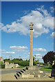
Market Cross
Apparently only the cross head is not original
Image: © Kevin Waterhouse
Taken: 26 Sep 2015
0.11 miles
10
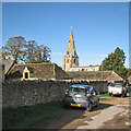
Towards Harringworth spire
"St John the Baptist. The W tower must have been begun before 1200 ... Clasping buttresses, lancets below, twin bell-openings of two lights separated by a shaft. Spire with low broaches. Big heads above the broaches. Three tiers of lucarnes. They look early C14" (Nikolaus Pevsner).
Image: © John Sutton
Taken: 25 Oct 2014
0.12 miles