
IMAGES TAKEN NEAR TO
Tordoff Place, KETTERING, NN16 0BW
Introduction
This page details the photographs taken nearby to Tordoff Place, NN16 0BW by members of the Geograph project.
The Geograph project started in 2005 with the aim of publishing, organising and preserving representative images for every square kilometre of Great Britain, Ireland and the Isle of Man.

There are currently over 7.5m images from over14,400 individuals and you can help contribute to the project by visiting https://www.geograph.org.uk
Image Map
Images are licensed for reuse under creativecommons.org/licenses/by-sa/2.0
Notes
- Clicking on the map will re-center to the selected point.
- The higher the marker number, the further away the image location is from the centre of the postcode.
Image Listing (74 Images Found)
Images are licensed for reuse under creativecommons.org/licenses/by-sa/2.0
Image
Details
Distance
2
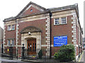
Kettering - Central Methodist Church
On School Lane.
Image: © Dave Bevis
Taken: 6 Apr 2012
0.04 miles
3
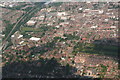
Kettering Town Centre: aerial 2014
From point abeam Wicksteed Park.
Image: © Chris
Taken: 2 Jul 2014
0.04 miles
4
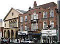
Kettering - east end of Gold Street
The church is the Fuller Baptist Church.
Image: © Dave Bevis
Taken: 6 Apr 2012
0.05 miles
5
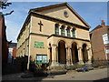
Fuller Baptist Church
In Gold Street.
Image: © Burgess Von Thunen
Taken: 29 Aug 2013
0.06 miles
7
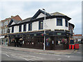
The Earl of Dalkeith Kettering
A Wetherspoon pub in Silver Street
Image: © John Firth
Taken: 13 Sep 2010
0.08 miles
8
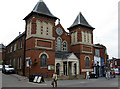
Toller Church, Kettering
The Toller Church, Gold St. is a United Reformed Church in the centre of Kettering.
Image: © Gordon Cragg
Taken: 17 Jun 2009
0.09 miles
10
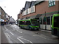
Bus outside Newlands Centre, Kettering
Near to Kettering's small bus station on Eskdaill Street, there is a row of bus stops on Newland Street outside the Newlands Centre that are provided with a single, long bus shelter partially built into the shopping centre. The bus seen here is wearing a special livery for Kettering town services that disguises its Stagecoach ownership. Bus routes within Kettering town are rather unusual in having letters instead of numbers; this bus is operating route A to Burton Latimer, which appears to have been replaced by an extension to the X1 since my visit to the town.
Image: © Richard Vince
Taken: 6 Mar 2010
0.10 miles