
IMAGES TAKEN NEAR TO
Alfred Street, NORTHAMPTON, NN1 5HB
Introduction
This page details the photographs taken nearby to Alfred Street, NN1 5HB by members of the Geograph project.
The Geograph project started in 2005 with the aim of publishing, organising and preserving representative images for every square kilometre of Great Britain, Ireland and the Isle of Man.

There are currently over 7.5m images from over14,400 individuals and you can help contribute to the project by visiting https://www.geograph.org.uk
Image Map
Images are licensed for reuse under creativecommons.org/licenses/by-sa/2.0
Notes
- Clicking on the map will re-center to the selected point.
- The higher the marker number, the further away the image location is from the centre of the postcode.
Image Listing (38 Images Found)
Images are licensed for reuse under creativecommons.org/licenses/by-sa/2.0
Image
Details
Distance
1
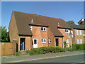
Alfred Street
1970s council houses in Abington.
Image: © Burgess Von Thunen
Taken: 9 May 2011
0.01 miles
2
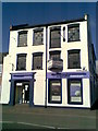
Alfred Street
Co-Operative Funeral Care on the corner of Stockley Street. The upper floors are currently to let with Chown Commercial. The building was recently occupied by Jeffery-West.
Image: © Burgess Von Thunen
Taken: 9 May 2011
0.02 miles
3
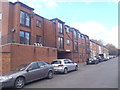
Vernon Court
1980s flats in Northampton.
Image: © Burgess Von Thunen
Taken: 13 Oct 2015
0.05 miles
4
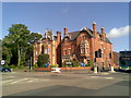
Billing Road
Large Victorian town houses converted to offices at the corner of Alfred Street and Cliftonville.
Image: © Burgess Von Thunen
Taken: 9 May 2011
0.05 miles
5
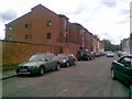
Vernon Terrace
1990s flats and Victorian houses in Abington.
Image: © Burgess Von Thunen
Taken: 10 Jun 2011
0.06 miles
6
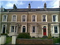
Billing Road
Regency terraces in an unusual yellow brick.
Image: © Burgess Von Thunen
Taken: 1 May 2011
0.09 miles
7
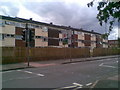
Billing Road
Flats in Green Park.
Image: © Burgess Von Thunen
Taken: 10 Jun 2011
0.09 miles
8
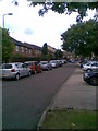
Vernon Walk
The back of 1970s council houses in Abington.
Image: © Burgess Von Thunen
Taken: 11 Jul 2011
0.10 miles
9
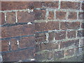
Benchmark near Nine Springs Villa
This bench mark was established in 1852 during the First primary levelling of England & Wales, and was levelled with a height of 264.556 feet [80.6367 metres] above mean sea level (Liverpool datum). It was included as a side level on the Towcester to King's Lynn levelling line. The surveyor's description was "No. 34(k). Mark on E. end of brick wall in front of Mr. Smith's house, Billing-road ; 0.87 ft. above surface" (Public Abstract p.310). The 1887 map shows this benchmark on the north face of the wall at north-east angle of the grounds of Nine Springs Villa. A modern office building now occupies this section of the grounds. The mark is relatively small (but compare the similar size of nearby 1GL marks) and not easy to see, just to the west of a pillar.
Image: © Shantavira
Taken: 16 May 2015
0.10 miles
10

Northampton from the air
Viewed from a Glasgow bound flight from Luton. The A45 road can be seen to the left, the recreation ground to the right.
Image: © Thomas Nugent
Taken: 4 Sep 2010
0.11 miles