IMAGES TAKEN NEAR TO
London Road, KETTERING, NN15 7QU
Introduction
This page details the photographs taken nearby to London Road, NN15 7QU by members of the Geograph project.
The Geograph project started in 2005 with the aim of publishing, organising and preserving representative images for every square kilometre of Great Britain, Ireland and the Isle of Man.

There are currently over 7.5m images from over14,400 individuals and you can help contribute to the project by visiting https://www.geograph.org.uk
Image Map
Images are licensed for reuse under creativecommons.org/licenses/by-sa/2.0
Notes
- Clicking on the map will re-center to the selected point.
- The higher the marker number, the further away the image location is from the centre of the postcode.
Image Listing (70 Images Found)
Images are licensed for reuse under creativecommons.org/licenses/by-sa/2.0
Image
Details
Distance
5
Corn Market Hall
Available for hire with "a selection of different sized rooms available catering for small meetings to birthday parties and conferences".
Image: © Andrew Tatlow
Taken: 1 Feb 2010
0.08 miles
6
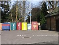
Recycling bins behind the Corn Market Hall
Image: © Andrew Tatlow
Taken: 1 Feb 2010
0.08 miles
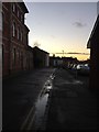
7
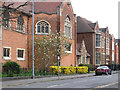
Kettering - west end of St Peter's Avenue
Image: © Dave Bevis
Taken: 6 Apr 2012
0.08 miles