IMAGES TAKEN NEAR TO
Pagent Court, KETTERING, NN15 6GR
Introduction
This page details the photographs taken nearby to Pagent Court, NN15 6GR by members of the Geograph project.
The Geograph project started in 2005 with the aim of publishing, organising and preserving representative images for every square kilometre of Great Britain, Ireland and the Isle of Man.

There are currently over 7.5m images from over14,400 individuals and you can help contribute to the project by visiting https://www.geograph.org.uk
Image Map
Images are licensed for reuse under creativecommons.org/licenses/by-sa/2.0
Notes
- Clicking on the map will re-center to the selected point.
- The higher the marker number, the further away the image location is from the centre of the postcode.
Image Listing (13 Images Found)
Images are licensed for reuse under creativecommons.org/licenses/by-sa/2.0
Image
Details
Distance
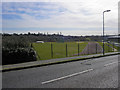
2
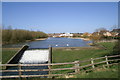
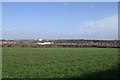
The Lake in front of Kettering Leisure Village
A View from the headlands showing the weir and lake in front of Kettering Leisure Village.
Image: © David Tucker
Taken: 9 Mar 2007
0.13 miles
3
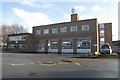
Kettering fire station
Kettering fire station, Headlands, Kettering, Northamptonshire
Image: © Kevin Hale
Taken: 5 Dec 2007
0.18 miles
4
A view looking across Kettering from Broughton Grange.
Looking towards Kettering General hospital across the fields from Broughton Grange.
Image: © David Tucker
Taken: 9 Mar 2007
0.18 miles
5
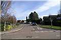
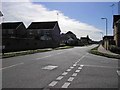
Headlands, Kettering
The Headlands taken from the railway bridge looking towards Kettering town centre.
Image: © David Tucker
Taken: 9 Mar 2007
0.18 miles
6
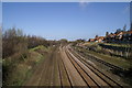
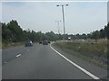
Midland Mainline
Midland Railway Mainline approaching Kettering Railway Station.
Image: © David Tucker
Taken: 9 Mar 2007
0.18 miles
7
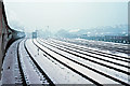
Railway sidings, Kettering, 1969
A mystery tour headed by "Flying Scotsman" heads towards Kettering station 79 minutes late, after starting from St. Pancras 53 minutes late. There was no snow down south, but still a murky day. These sidings are no more.
Image: © Robin Webster
Taken: 22 Feb 1969
0.21 miles
8
Kettering Athletics Club
The Athletics club taken from Thurston Drive.
Image: © David Tucker
Taken: 13 Mar 2007
0.22 miles
9
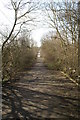
Headlands, Kettering
A view of the Headlands from the railway bridge. This road used to have traffic which went to Kettering Golf Club. When a new housing estate was built beside the lake, at the bottom of the hill, it became a foot/cycle path.
Image: © David Tucker
Taken: 9 Mar 2007
0.22 miles