
IMAGES TAKEN NEAR TO
Perry Street, NORTHAMPTON, NN1 4HW
Introduction
This page details the photographs taken nearby to Perry Street, NN1 4HW by members of the Geograph project.
The Geograph project started in 2005 with the aim of publishing, organising and preserving representative images for every square kilometre of Great Britain, Ireland and the Isle of Man.

There are currently over 7.5m images from over14,400 individuals and you can help contribute to the project by visiting https://www.geograph.org.uk
Image Map
Images are licensed for reuse under creativecommons.org/licenses/by-sa/2.0
Notes
- Clicking on the map will re-center to the selected point.
- The higher the marker number, the further away the image location is from the centre of the postcode.
Image Listing (72 Images Found)
Images are licensed for reuse under creativecommons.org/licenses/by-sa/2.0
Image
Details
Distance
1
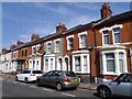
Adnitt Road
Victorian terraces in Abington.
Image: © Burgess Von Thunen
Taken: 12 Jun 2015
0.03 miles
2
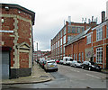
Northampton: Turner Street
Looking across the Magee Street crossroads towards the side of Crockett & Jones' shoe factory.
Image: © John Sutton
Taken: 17 Aug 2014
0.05 miles
3
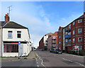
Northampton: the junction of Stimpson Avenue and Adnitt Road
Though just outside the Boot and Shoe Quarter conservation area, this part of Northampton is typical, with its streets of factories and terraced houses. Many of the former shoe factories, like the one in the centre middle distance, are now flats. Purpose-built flats are more recent.
Image: © John Sutton
Taken: 20 Sep 2017
0.06 miles
4
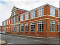
Northampton: the Crockett & Jones shoe factory
The Magee Street frontage, photographed on a Sunday morning after rain. Unlike others in the area, this is still an active shoe factory - http://www.crockettandjones.com/heritage .
Image: © John Sutton
Taken: 17 Aug 2014
0.07 miles
5
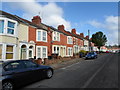
Adams Avenue
Victorian terraces in Abington.
Image: © Burgess Von Thunen
Taken: 17 Aug 2014
0.07 miles
6
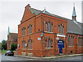
Northampton: St Michael's Church Hall
The large parish hall, now in commercial use, is in the same red-brick Early English style as the church, with groups of iron-framed lancet windows. The church, on the left, is shown more clearly in Image
Image: © John Sutton
Taken: 17 Aug 2014
0.07 miles
7
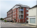
Northampton: former shoe factory
A view across the junction of Stimpson Avenue and Adnitt Road, showing what was Green & Sons (Northampton) Limited's factory, now flats. Image] is a closer view of the grand main entrance.
Image: © John Sutton
Taken: 17 Aug 2014
0.07 miles
8
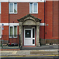
Northampton: former factory doorway
The Stimpson Avenue shoe factory of Green & Sons (Northampton) Ltd is now flats. For the wider context, see Image
Image: © John Sutton
Taken: 17 Aug 2014
0.07 miles
9
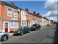
Derby Road
Victorian terraces in Abington.
Image: © Burgess Von Thunen
Taken: 18 Aug 2014
0.09 miles
10
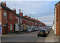
Northampton: Derby Road
A typical terraced street on the edge of the Boot and Shoe Quarter.
Image: © John Sutton
Taken: 20 Sep 2017
0.09 miles