IMAGES TAKEN NEAR TO
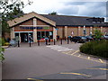
Poppyfield Court, KETTERING, NN14 4TS
Introduction
This page details the photographs taken nearby to Poppyfield Court, NN14 4TS by members of the Geograph project.
The Geograph project started in 2005 with the aim of publishing, organising and preserving representative images for every square kilometre of Great Britain, Ireland and the Isle of Man.

There are currently over 7.5m images from over14,400 individuals and you can help contribute to the project by visiting https://www.geograph.org.uk
Image Map (Loading...)


Getting Data...Please wait
Leaflet Map data © OpenStreetMap
Images are licensed for reuse under creativecommons.org/licenses/by-sa/2.0
Notes
- Clicking on the map will re-center to the selected point.
- The higher the marker number, the further away the image location is from the centre of the postcode.
Image Listing (45 Images Found)
Images are licensed for reuse under creativecommons.org/licenses/by-sa/2.0
Image
Details
Distance
1
Thrapston - Springfield Avenue At Mallard Close
Image: © Peter Whatley
Taken: 2 Jun 2009
0.11 miles
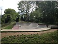
2
Thrapston - Mallard Close
Not a wader in sight.
Image: © Peter Whatley
Taken: 2 Jun 2009
0.13 miles
6
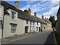
Chancery Lane, Thrapston
Eighteenth and nineteenth century houses. All are listed buildings.
Image: © Jonathan Thacker
Taken: 28 Jun 2020
0.19 miles
7
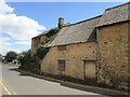
Derelict cottage, Chancery Lane, Thrapston
Image: © Jonathan Thacker
Taken: 28 Jun 2020
0.19 miles
8
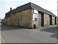
Chancery Auto's in Chancery lane
A garage with big doors, could have been a truck or bus garage possibly.
Image: © Michael Trolove
Taken: 3 Apr 2011
0.20 miles
9
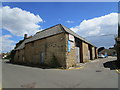
Chancery Autos, Thrapston
This was probably outbuildings to premises on the High Street.
Image: © Jonathan Thacker
Taken: 28 Jun 2020
0.20 miles