IMAGES TAKEN NEAR TO
Navisford Close, KETTERING, NN14 4TG
Introduction
This page details the photographs taken nearby to Navisford Close, NN14 4TG by members of the Geograph project.
The Geograph project started in 2005 with the aim of publishing, organising and preserving representative images for every square kilometre of Great Britain, Ireland and the Isle of Man.

There are currently over 7.5m images from over14,400 individuals and you can help contribute to the project by visiting https://www.geograph.org.uk
Image Map (Loading...)


Getting Data...Please wait
Leaflet Map data © OpenStreetMap
Images are licensed for reuse under creativecommons.org/licenses/by-sa/2.0
Notes
- Clicking on the map will re-center to the selected point.
- The higher the marker number, the further away the image location is from the centre of the postcode.
Image Listing (9 Images Found)
Images are licensed for reuse under creativecommons.org/licenses/by-sa/2.0
Image
Details
Distance
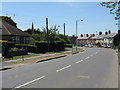
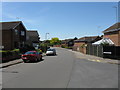
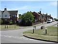
1
Thrapston - Houses Off Springfield Avenue
Image: © Peter Whatley
Taken: 2 Jun 2009
0.01 miles
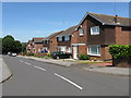
3
Thrapston - Mallard Close
Not a wader in sight.
Image: © Peter Whatley
Taken: 2 Jun 2009
0.10 miles
4
Thrapston - Springfield Avenue At Mallard Close
Image: © Peter Whatley
Taken: 2 Jun 2009
0.12 miles
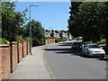
7
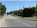
Thrapston - Oundle Road
Looking east from opposite the junction with John Street.
Image: © Peter Whatley
Taken: 2 Jun 2009
0.17 miles
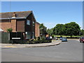
8
Thrapston - John Street
Photographed from across Oundle Road.
Image: © Peter Whatley
Taken: 2 Jun 2009
0.20 miles