IMAGES TAKEN NEAR TO
Huntingdon Road, KETTERING, NN14 4PT
Introduction
This page details the photographs taken nearby to Huntingdon Road, NN14 4PT by members of the Geograph project.
The Geograph project started in 2005 with the aim of publishing, organising and preserving representative images for every square kilometre of Great Britain, Ireland and the Isle of Man.

There are currently over 7.5m images from over14,400 individuals and you can help contribute to the project by visiting https://www.geograph.org.uk
Image Map
Images are licensed for reuse under creativecommons.org/licenses/by-sa/2.0
Notes
- Clicking on the map will re-center to the selected point.
- The higher the marker number, the further away the image location is from the centre of the postcode.
Image Listing (8 Images Found)
Images are licensed for reuse under creativecommons.org/licenses/by-sa/2.0
Image
Details
Distance
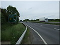
4
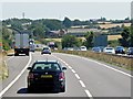
Layby on the Eastbound A14 near Thrapston
Image: © David Dixon
Taken: 1 Aug 2013
0.15 miles
5

IKEA Distribution Centre
Looking north. The photo shows only a small corner of this huge warehouse, which covers an area of some 200 X 350 square metres.
Image: © Will Lovell
Taken: 29 Mar 2006
0.15 miles
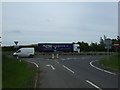
6
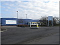
Primark Distribution Centre
What was an IKEA warehouse has now become a Primark warehouse with DHL handling the logistics.
Image: © Michael Trolove
Taken: 21 Feb 2009
0.21 miles
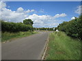
7
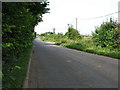
The road from Thrapston to Titchmarsh
Image: © David Purchase
Taken: 21 Jul 2012
0.21 miles
8
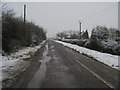
Road to Newbrook Farm
Road passing The Bungalow heading up to Newbrook Farm
Image: © Shaun Ferguson
Taken: 11 Feb 2013
0.24 miles