
IMAGES TAKEN NEAR TO
Fermyn Woods, KETTERING, NN14 3JA
Introduction
This page details the photographs taken nearby to Fermyn Woods, NN14 3JA by members of the Geograph project.
The Geograph project started in 2005 with the aim of publishing, organising and preserving representative images for every square kilometre of Great Britain, Ireland and the Isle of Man.

There are currently over 7.5m images from over14,400 individuals and you can help contribute to the project by visiting https://www.geograph.org.uk
Image Map
Images are licensed for reuse under creativecommons.org/licenses/by-sa/2.0
Notes
- Clicking on the map will re-center to the selected point.
- The higher the marker number, the further away the image location is from the centre of the postcode.
Image Listing (16 Images Found)
Images are licensed for reuse under creativecommons.org/licenses/by-sa/2.0
Image
Details
Distance
1
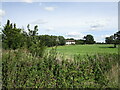
Grassland and the Old Water Tower
The former water tower dates from 1900.
Image: © Jonathan Thacker
Taken: 2 Sep 2019
0.01 miles
2
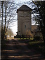
The Old Water Tower
Described as the old water tower on magic.defra.gov.uk. Presumably because it is unused and replaced by mains water. A Contemporary Art Gallery occupies some of the adjoining buildings.
http://www.fermynwoods.co.uk/
Image: © Michael Trolove
Taken: 21 Feb 2009
0.03 miles
4
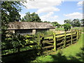
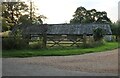
Building at the entrance to Fermyn Woods Hall
Image: © Jonathan Thacker
Taken: 29 Jul 2019
0.04 miles
5
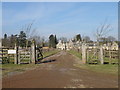
Fermyn Woods Hall
The main tree lined drive to the hall.
Image: © Michael Trolove
Taken: 21 Feb 2009
0.09 miles
6
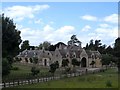
Fermyn Wood Hall
Originally built in the C17 and altered in C18, C19 and C20.
Image: © Bikeboy
Taken: 27 Jun 2015
0.10 miles
7
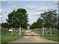
Entrance to Fermyn Woods Hall
Fermyn Woods Hall dates from the seventeenth century https://historicengland.org.uk/listing/the-list/list-entry/1189160
Image: © Jonathan Thacker
Taken: 2 Sep 2019
0.11 miles
8
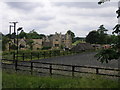
Fermyn Wood Hall
It would appear that part of Fermyn Wood has had to give way to create the parkland which surrounds the hall.
Image: © Michael Patterson
Taken: 14 Jun 2006
0.12 miles
9

Bridleway along the edge of a wheatfield
Much of the wheat in this area is almost ready for harvesting but this field was sown in the spring and harvest is some time off yet.
Image: © Jonathan Thacker
Taken: 29 Jul 2019
0.14 miles
10
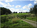
Roadway and Samby Sykes
Samby Sykes is the woodland on the left of the picture.
Image: © Jonathan Thacker
Taken: 2 Sep 2019
0.16 miles