
IMAGES TAKEN NEAR TO
Grafton Road, KETTERING, NN14 3EY
Introduction
This page details the photographs taken nearby to Grafton Road, NN14 3EY by members of the Geograph project.
The Geograph project started in 2005 with the aim of publishing, organising and preserving representative images for every square kilometre of Great Britain, Ireland and the Isle of Man.

There are currently over 7.5m images from over14,400 individuals and you can help contribute to the project by visiting https://www.geograph.org.uk
Image Map
Images are licensed for reuse under creativecommons.org/licenses/by-sa/2.0
Notes
- Clicking on the map will re-center to the selected point.
- The higher the marker number, the further away the image location is from the centre of the postcode.
Image Listing (70 Images Found)
Images are licensed for reuse under creativecommons.org/licenses/by-sa/2.0
Image
Details
Distance
1
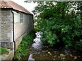
Harper's Brook, Brigstock, 2
Looking south from the bridge on Grafton Road.
Image: © Jonathan Billinger
Taken: 9 Oct 2013
0.07 miles
2
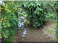
Harper's Brook, Brigstock, 1
Looking north from the bridge on Grafton Road.
Image: © Jonathan Billinger
Taken: 9 Oct 2013
0.07 miles
3
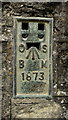
Flush Bracket 1873: Brigstock, Harper's Brook Bridge
This flush bracket was used during the Second geodetic levelling, England & Wales, and was levelled with a height of 172.5310 feet [52.5874 metres] above mean sea level (Newlyn datum). It was included on the Cranford to Castor levelling line. The surveyor's description was Flush Bracket on centre of parapet of bridge over Harper's Brook, S. end of Brigstock.
Image: © Jonathan Billinger
Taken: 9 Oct 2013
0.08 miles
4
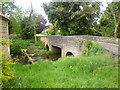
Brigstock, roadbridge
Carrying Grafton Road over Harper's Brook.
Image: © Mike Faherty
Taken: 11 May 2014
0.08 miles
5
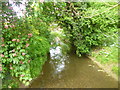
Brigstock, Harper's Brook
Looking upstream at a brook that drains into River Nene; seen from Image
Image: © Mike Faherty
Taken: 11 May 2014
0.08 miles
6
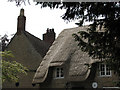
Brigstock: new thatch
New thatch on a limestone cottage near the church.
Image: © John Sutton
Taken: 1 Jun 2011
0.09 miles
7
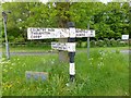
Old Direction Sign - Signpost in Brigstock
No finial - 3 arms; Northants concrete by the UC road, in parish of Brigstock (East Northamptonshire District), junction of Grafton Road with Benefield Road, on green.
Surveyed
Milestone Society National ID: NR_SP9485
Image: © Milestone Society
Taken: Unknown
0.10 miles
8
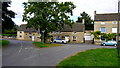
Grass triangle with oak tree, Brigstock
The T junction of Grafton Road with Church Street (left) and Sudborough Road (right).
Image: © Jonathan Billinger
Taken: 9 Oct 2013
0.10 miles
9
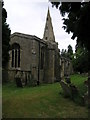
St Andrew's
The parish church in Brigstock is dedicated to St Andrew the Apostle. A sign directing you to the church suggests Saxon origins.
Image: © Michael Patterson
Taken: 14 Jun 2006
0.10 miles
10
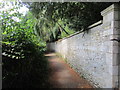
Footpath from the church, Brigstock
Leads to Park Walk.
Image: © Jonathan Thacker
Taken: 29 Jul 2019
0.11 miles