
IMAGES TAKEN NEAR TO
Chase Farm, KETTERING, NN14 1RA
Introduction
This page details the photographs taken nearby to Chase Farm, NN14 1RA by members of the Geograph project.
The Geograph project started in 2005 with the aim of publishing, organising and preserving representative images for every square kilometre of Great Britain, Ireland and the Isle of Man.

There are currently over 7.5m images from over14,400 individuals and you can help contribute to the project by visiting https://www.geograph.org.uk
Image Map
Images are licensed for reuse under creativecommons.org/licenses/by-sa/2.0
Notes
- Clicking on the map will re-center to the selected point.
- The higher the marker number, the further away the image location is from the centre of the postcode.
Image Listing (156 Images Found)
Images are licensed for reuse under creativecommons.org/licenses/by-sa/2.0
Image
Details
Distance
1
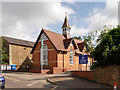
Geddington Church of England Primary School, Wood Street
Image: © David Dixon
Taken: 18 Sep 2017
0.03 miles
2
![Geddington buildings [3]](https://s3.geograph.org.uk/geophotos/07/12/79/7127983_1825d458_120x120.jpg)
Geddington buildings [3]
This delightful Victorian building is part of the Geddington Church of England Primary School.
Geddington is a village in Northamptonshire, on the main road between Kettering, about 3 miles southwest, and Corby, about 4 miles north. The River Ise runs through the village and is crossed by a medieval bridge. There is evidence of Iron Age, Roman and Saxon occupation. The village is home to the best preserved Eleanor cross of the three remaining. A Royal hunting lodge once stood to the north of the village but no trace remains.
Image: © Michael Dibb
Taken: 26 Sep 2021
0.03 miles
3
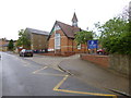
Geddington, primary school
Geddington Church of England Primary School, on Wood Street; the building is dated 1898: http://www.geddingtonschool.co.uk/
Image: © Mike Faherty
Taken: 11 May 2014
0.03 miles
4
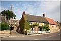
Wood Street cottage
Cottage on the corner of Wood Street and Church Gate
Image: © Richard Croft
Taken: 23 Aug 2007
0.04 miles
5
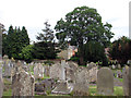
Geddington: St Mary Magdalene - churchyard
The majority of the graves are on the north side of the church. For more about the church, see http://www.geddington.net/church/history.htm
Image: © John Sutton
Taken: 1 Jun 2011
0.04 miles
6
![Geddington houses [31]](https://s0.geograph.org.uk/geophotos/07/12/79/7127972_17dce677_120x120.jpg)
Geddington houses [31]
Once incorporating a shop, number 1 Wood Street is now purely residential. Built in the 17th and 18th centuries with later alterations. The front range is of coursed limestone rubble stone, the rear wing is of red brick. The roof is of concrete tiles, with slate to the rear of the front block. Listed, grade II, with details at: https://historicengland.org.uk/listing/the-list/list-entry/1372383
Geddington is a village in Northamptonshire, on the main road between Kettering, about 3 miles southwest, and Corby, about 4 miles north. The River Ise runs through the village and is crossed by a medieval bridge. There is evidence of Iron Age, Roman and Saxon occupation. The village is home to the best preserved Eleanor cross of the three remaining. A Royal hunting lodge once stood to the north of the village but no trace remains.
Image: © Michael Dibb
Taken: 26 Sep 2021
0.05 miles
7
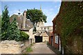
Church Gate
Narrow lane approaching St.Mary Magdalene's church from Wood Street
Image: © Richard Croft
Taken: 23 Aug 2007
0.05 miles
8
![Parish church [2]](https://s0.geograph.org.uk/geophotos/07/12/58/7125844_9679cdfc_120x120.jpg)
Parish church [2]
The churchyard.
The Anglican parish church of St Mary Magdalene has Anglo-Saxon origins. There are parts from the 12th, 13th and 14th centuries. The tower was heightened and there were other alterations in the 15th century. The church was restored and the porch added in the 19th century. There was another restoration in 1904-6. Constructed of coursed limestone rubble with ashlar roofs, probably of lead. Listed, grade I, with details at: https://historicengland.org.uk/listing/the-list/list-entry/1052076
Geddington is a village in Northamptonshire, on the main road between Kettering, about 3 miles southwest, and Corby, about 4 miles north. The River Ise runs through the village and is crossed by a medieval bridge. There is evidence of Iron Age, Roman and Saxon occupation. The village is home to the best preserved Eleanor cross of the three remaining. A Royal hunting lodge once stood to the north of the village but no trace remains.
Image: © Michael Dibb
Taken: 26 Sep 2021
0.05 miles
9
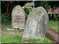
Geddington: St Mary Magdalene - churchyard
Weathered headstones. For more about the church, see http://www.geddington.net/church/history.htm
Image: © John Sutton
Taken: 1 Jun 2011
0.05 miles
10
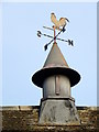
Weather vane, The Old School
The weather vane is on the Old School. For a wider view of the building Image
As long as humans have farmed the land, sailed the seas and contemplated their place in nature, the wind has played a key role in their speculations. It was interpreting the wind's changing direction that helped our ancestors predict the coming weather and survive.
Image: © Maigheach-gheal
Taken: 2 Apr 2011
0.06 miles